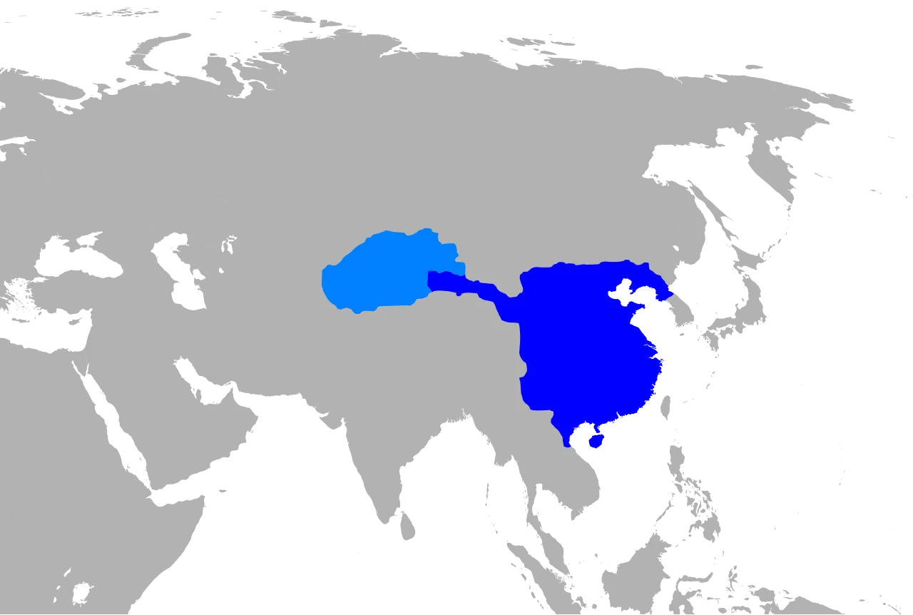
Han Dynasty 2 BC (cropped)
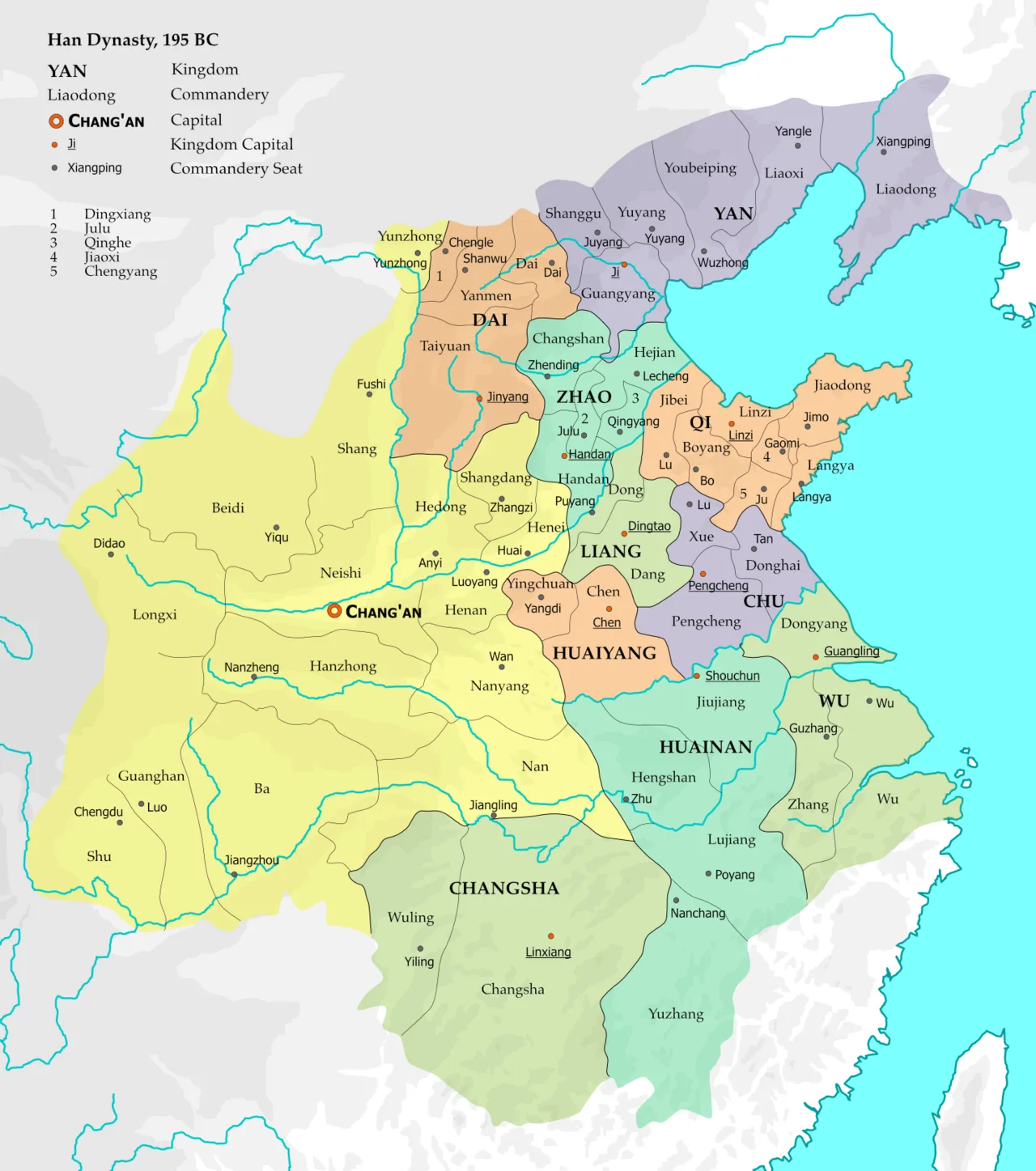
Thirteen direct-controlled commanderies including the capital region (yellow) and ten semi-autonomous kingdoms, 195 BC
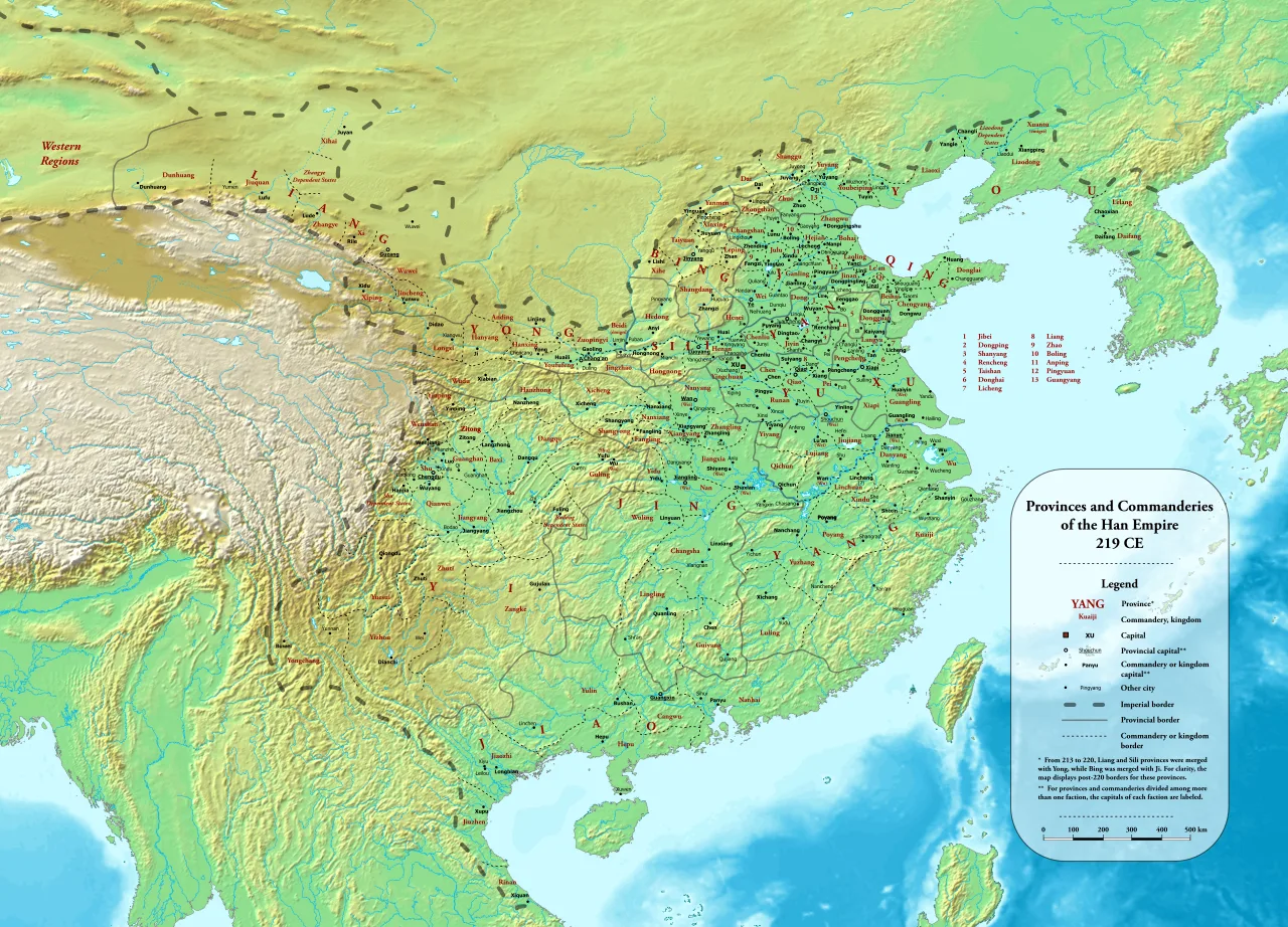
Provinces and commanderies in 219 AD, the penultimate year of the Han dynasty
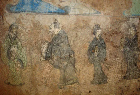
A Western Han fresco depicting Confucius and Laozi, from a tomb of Dongping County, Shandong
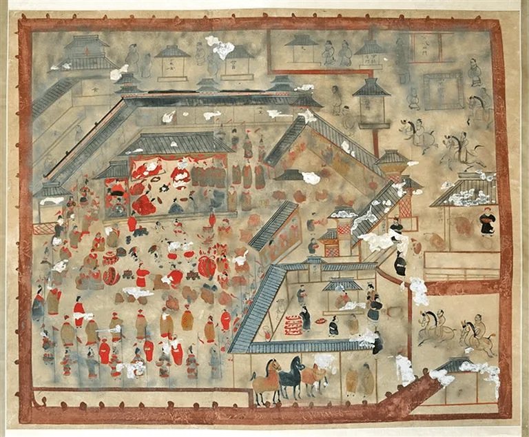
An Eastern Han (25–220) period Chinese mural of a mufu conference conducted by the Commandant-protector of the Wuhuan (护乌桓校尉) at his manor, from a Han tomb in Horinger, Inner Mongolia
![A stone-carved que 6 m (20 ft) in height from the Eastern Han, at the tomb of Gao Yi in Ya'an, Sichuan[397]](https://nwjvzop1xgplmzvt.public.blob.vercel-storage.com/wikifeed/han-dynasty/5-4b86659bd3.webp)
A stone-carved que 6 m (20 ft) in height from the Eastern Han, at the tomb of Gao Yi in Ya'an, Sichuan[397]
Han dynasty
The Han dynasty was an imperial dynasty of China established by Liu Bang, separated into the Western Han (202 BC – 9 AD) and Eastern Han (25–220 AD) periods.
Bureaucracy Borrowed from a Vilified Dynasty
While later commentators frequently portrayed the preceding Qin regime as exceptionally tyrannical, the Han legal system relied directly on its predecessor's foundation. Recovered administrative artifacts from Zhangjiashan and Shuihudi demonstrate that Chancellor Xiao He preserved substantial portions of Qin law when drafting the Han statutes. Rather than building from scratch, early rulers adapted existing authoritarian structures into their own imperial framework.
From Wikipedia · CC BY-SA 4.0
![Territory of the Qin dynasty,[note 1] with population centres and segments of the Great Wall marked](https://nwjvzop1xgplmzvt.public.blob.vercel-storage.com/wikifeed/qin-dynasty/0-4dcfa8ce9b.webp)
Territory of the Qin dynasty,[note 1] with population centres and segments of the Great Wall marked
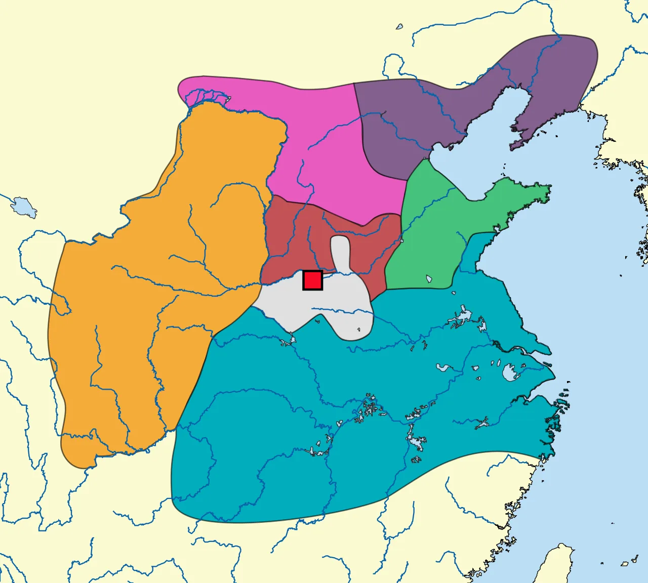
Territories of the Seven Warring States c. 250 BC, with the former capital of the Zhou royal family at Luoyang marked .mw-parser-output .div-col{margin-top:0.3em;column-width:30em}.mw-parser-output .div-col-small{font-size:90%}.mw-parser-output .div-col-rules{column-rule:1px solid #aaa}.mw-parser-output .div-col dl,.mw-parser-output .div-col ol,.mw-parser-output .div-col ul{margin-top:0}.mw-parser-output .div-col li,.mw-parser-output .div-col dd{page-break-inside:avoid;break-inside:avoid-column} Qin Zhao Yan Wei Qi Han Chu
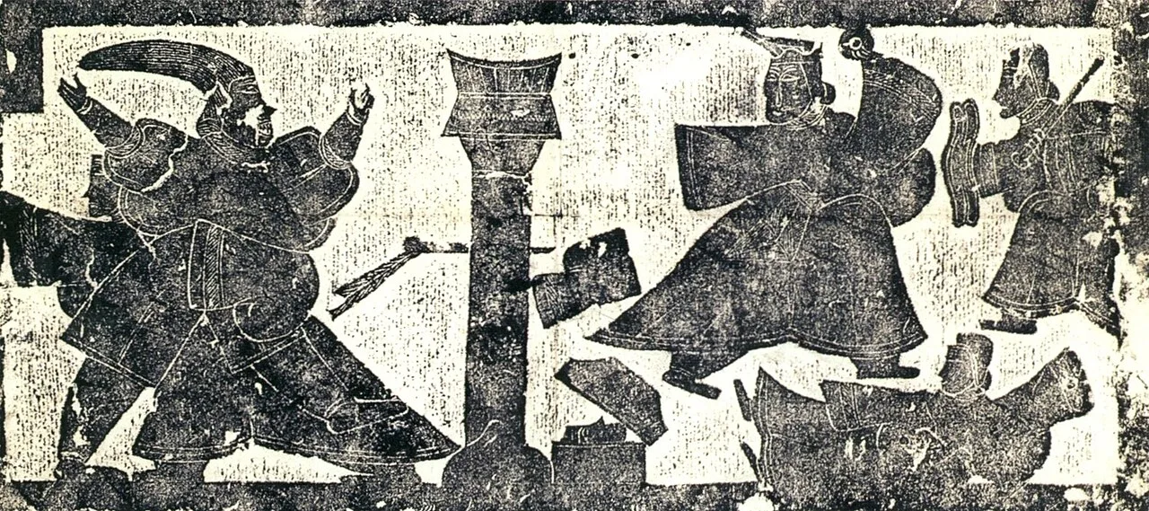
Rubbing of a Han-era stone relief depicting the 227 BC assassination attempt on the future Qin Shi Huang (right) by Jing Ke (left). Jing is held by a court physician (background), as a soldier (far right) rushes to save the emperor, who holds an imperial jade disc. Jing's dagger (centre) has become stuck in a pillar.
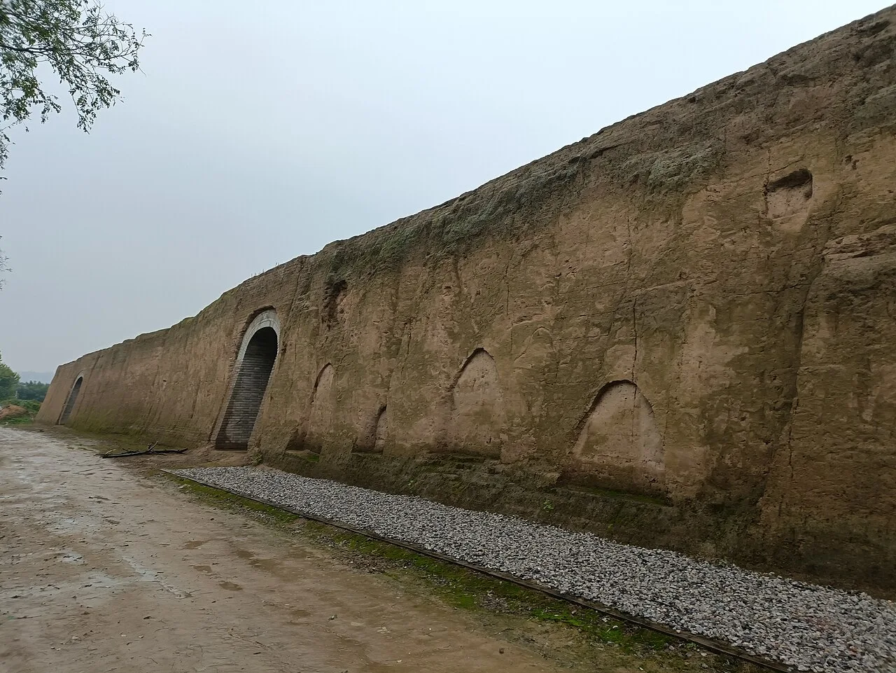
Excavation of the western platform
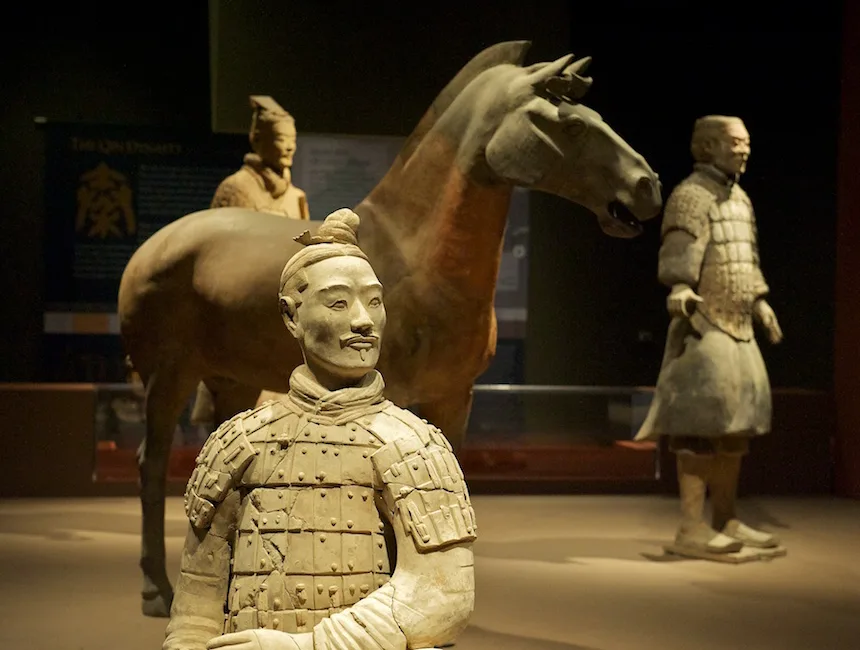
Warriors and horse from the Terracotta Army

"Qin" in seal script (top) and regular script (bottom) Chinese characters
Qin dynasty
The Qin dynasty was the first imperial dynasty of China, named after its progenitor state of Qin.
From Royal Horse Pasture to Vassal Powerhouse
Long before conquering rival states, the Qin began as a modest frontier outpost focused on animal husbandry. In 897 BC, during the Gonghe Regency, the settlement was allocated as a dependency dedicated to raising horses for the Zhou. Generations later, Duke Zhuang and Duke Xiang aided the Zhou dynasty against the Western Rong, securing expanded territory. This assistance allowed Duke Xiang to formally establish Qin as a major vassal state.
From Wikipedia · CC BY-SA 4.0
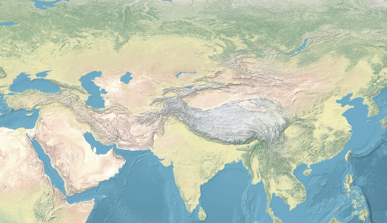
Xiongnu is located in Continental Asia
![A nomad horseman spearing a boar, discovered in Saksanokhur, South Tajikistan, 1st–2nd century AD.[50][51] According to](https://nwjvzop1xgplmzvt.public.blob.vercel-storage.com/wikifeed/xiongnu/1-bf3a28332d.webp)
A nomad horseman spearing a boar, discovered in Saksanokhur, South Tajikistan, 1st–2nd century AD.[50][51] According to Francfort, this decorative belt buckle may have been made for a patron related to the Xiongnu, and may be dated to the 2nd-1st century BC. The rider wears the steppe dress, his hair is tied into a hairbun characteristic of the oriental steppes, and his horse has characteristically Xiongnu horse trappings.[52]
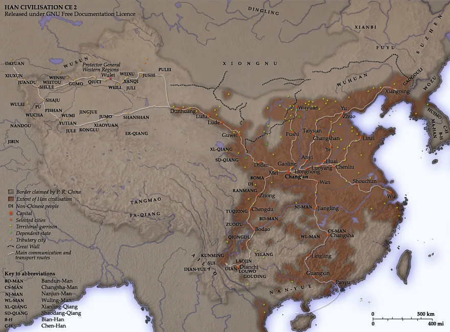
The Han dynasty in 2 AD
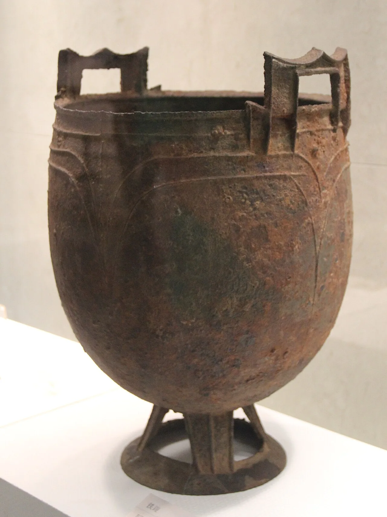
Xiongnu cauldron, Eastern Han
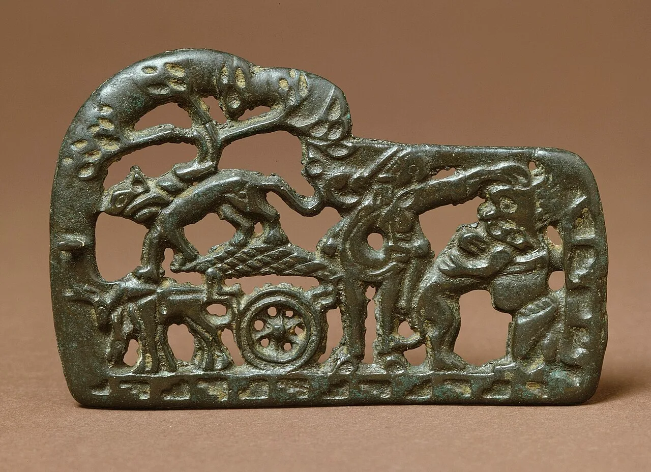
Belt Buckle, 2nd–1st century BC, Xiongnu. Another naturalistic belt buckle made to the Xiongnu taste, showing a mounted warrior frontally, holding a dagger and grabbing the hair of a demon who is also attacked by a dog. Also appears a nomadic cart pulled by reindeers, and another dog on top of the cart.[199][200][92][201]
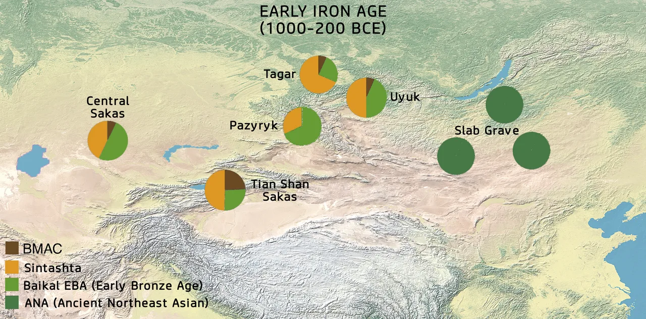
Pre-Xiongnu populations. The Slab-grave people were uniformly of Ancient Northeast Asian origin (ANA ), while Saka populations to the west combined Sintashta ( ) and Ancient Northeast Asian (Baikal EBA ) ancestry, with some BMAC component.
Xiongnu
The Xiongnu were a tribal confederation of nomadic peoples who inhabited the eastern Eurasian Steppe from the 3rd century BC to the late 1st century AD, centred on the Mongolian Plateau.
Deriving *Xoŋai from the Ongi River
Sinologist Axel Schuessler reconstructed the Old Chinese pronunciation of Xiongnu as *hoŋ-nâ, linking it to foreign names like the Sanskrit Hūṇā. In contrast, Christopher P. Atwood derived *Xoŋai from the Ongi River, arguing the name was originally dynastic rather than ethnic. These divergent analyses demonstrate that the confederation's historical identifier remains contested between external designations and native geographic labels.
From Wikipedia · CC BY-SA 4.0
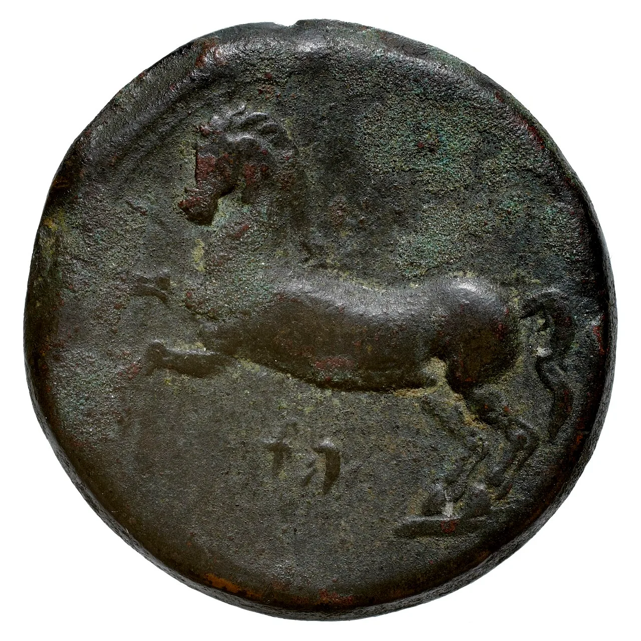
Flag of Numidia
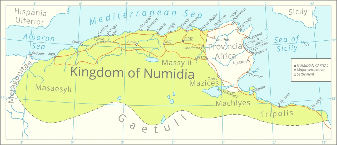
Map of Numidia after the Punic Wars
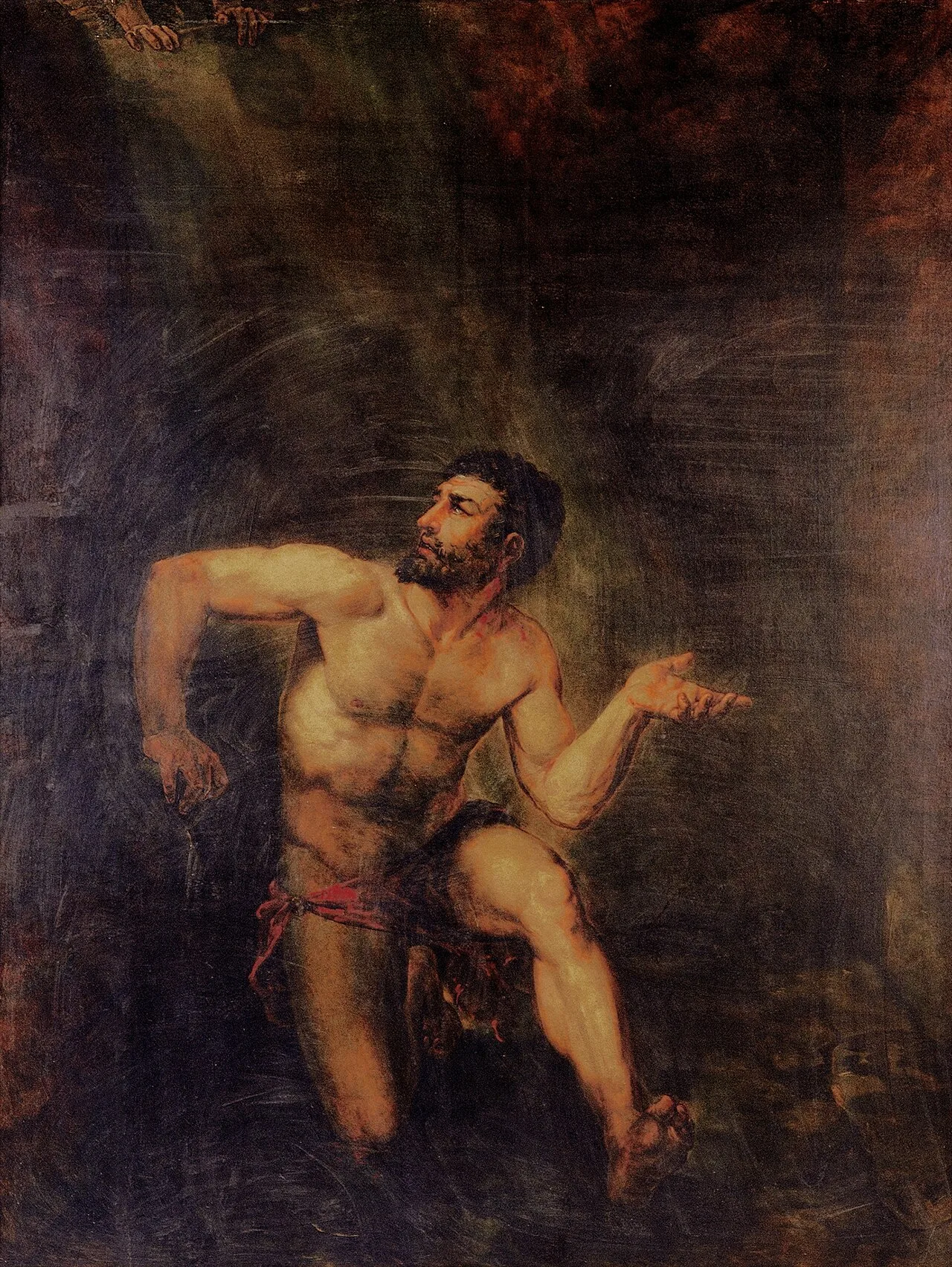
Jugurtha, by Augusto Müller (1815–1883). Museu Nacional de Belas Artes.
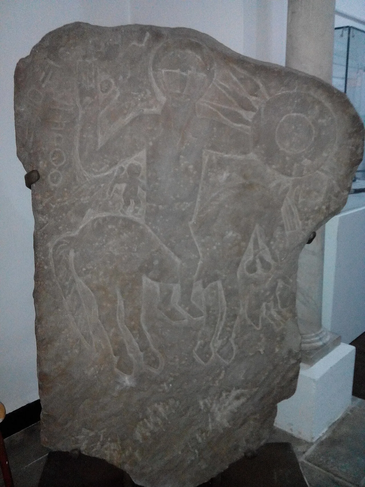
Numidian cavalryman stele
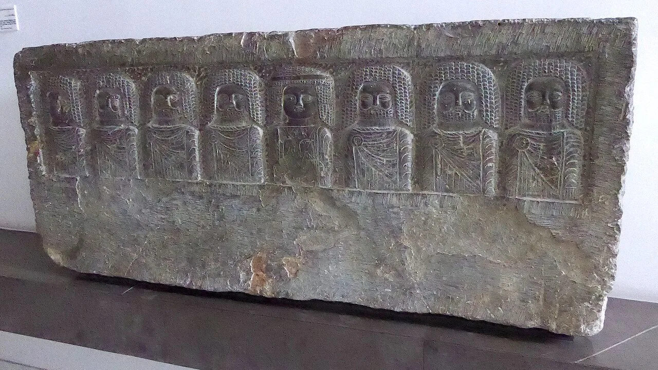
Pantheon of Numidian deities. Bardo Museum
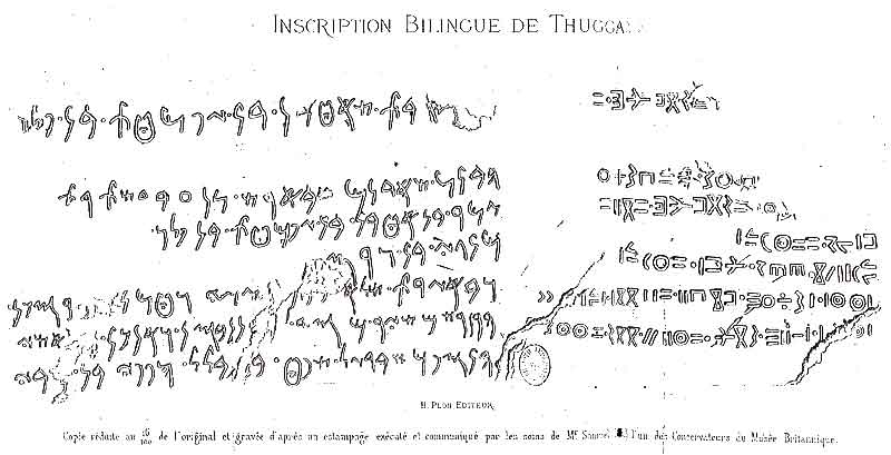
Bilingual inscription (Numidian and Punic) from Thugga, Dougga, Tunisia
Numidia
Numidia was the ancient Libyan kingdom of the indigenous Numidian Berbers in Northwest Africa during the Hellenistic period.
A Roman Centurion's Berber Legion
Numidian power is often associated with light cavalry, yet kings deliberately engineered disciplined ground forces. In 213 BC, the Masaesylian king Syphax sought Roman assistance to counter his army's infantry deficit. The centurion Quintus Statorius trained these recruits in tactical maneuvers, regular infantry duties, and building fortified camps, rapidly turning them into an effective fighting unit against the Carthaginians.
From Wikipedia · CC BY-SA 4.0
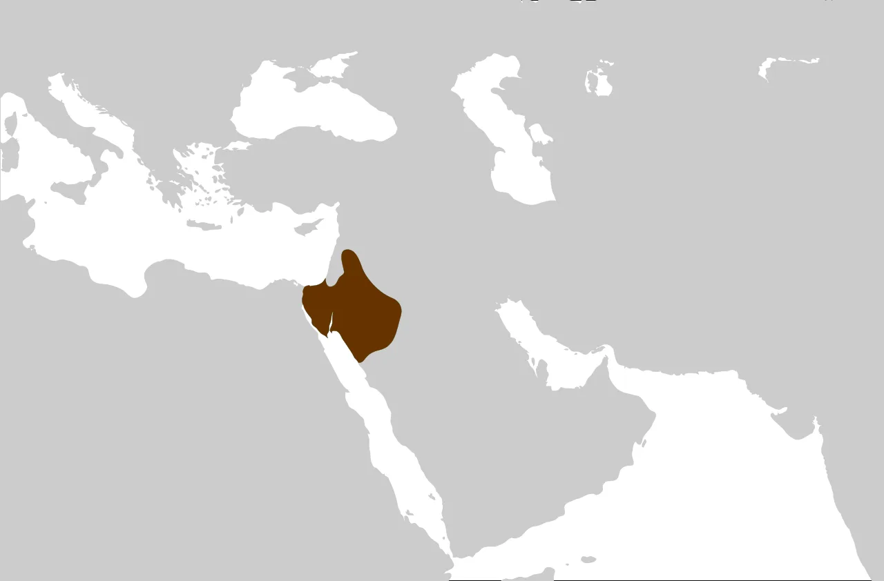
The Nabataean Kingdom at its greatest extent
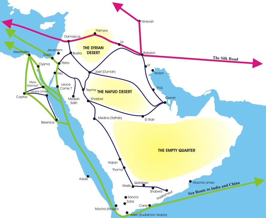
Trading routes of the ancient Middle East, when Petra was the last stop for caravans carrying spices before being shipped to European markets through the Port of Gaza
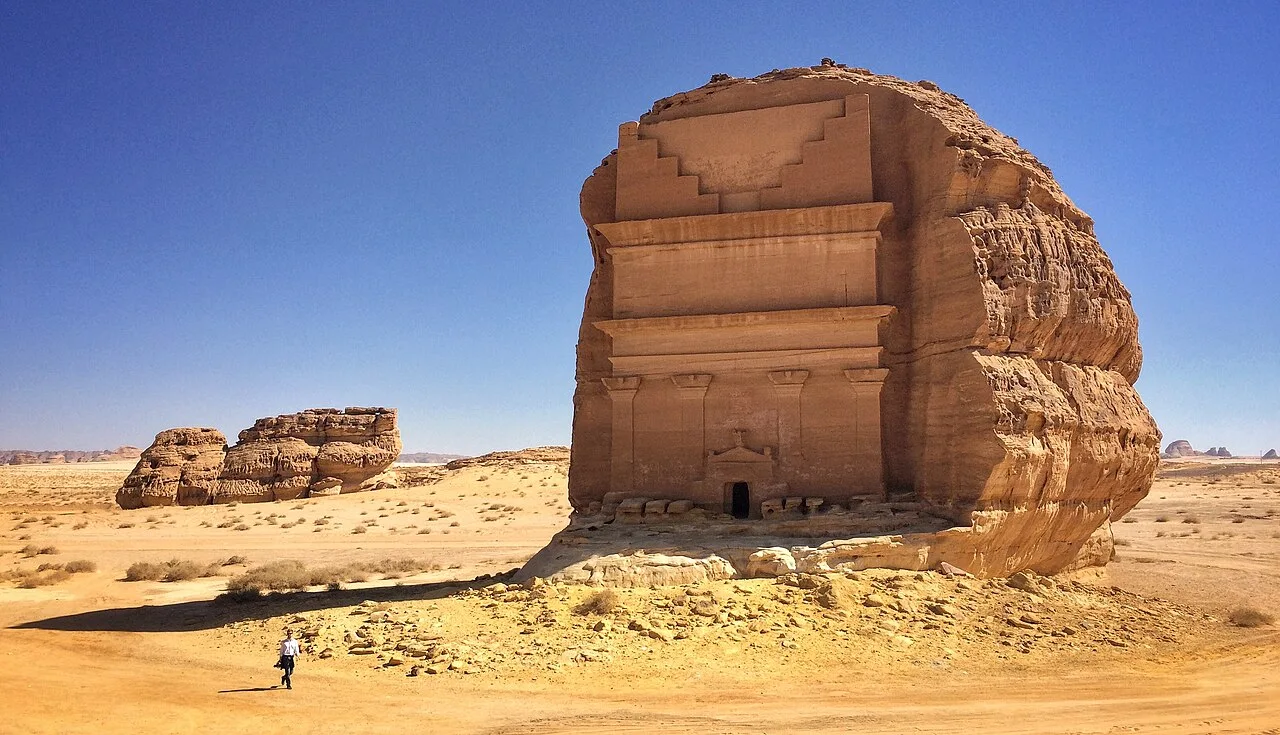
A Nabataean tomb, Qasr al-Farid, part of Mada'in Saleh archaeological site, located at al-Ula, Hejaz, Saudi Arabia

Al-Khazneh was carved into rock by the Nabataeans in their capital, Petra.
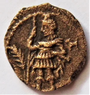
Coin showing Aretas IV in military dress
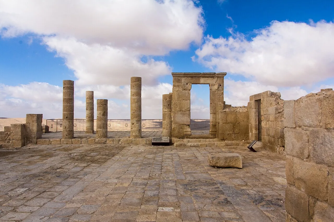
Remains of Byzantine church at Avdat in the Negev, which reused elements of a temple built by the Nabataeans to commemorate king Obodas I and his victories against the Hasmoneans and the Seleucids
Nabataean Kingdom
The Nabataean Kingdom was a political state of the Nabataeans during classical antiquity, remaining independent from the mid-3rd century BC until its annexation by the Roman Empire in AD 106.
Mistaken Identities from Assyria to Genesis
Common historical assumptions often conflated the Nabataeans with other ancient Near Eastern populations purely on phonetic similarities. Outside observers frequently misidentified them with the Nabaiti, a distinct group defeated by the Assyrian King Ashurbanipal. A parallel misconception linked the tribe to Nebaioth, recorded in the Hebrew Bible as the son of Abraham through Ishmael.
From Wikipedia · CC BY-SA 4.0
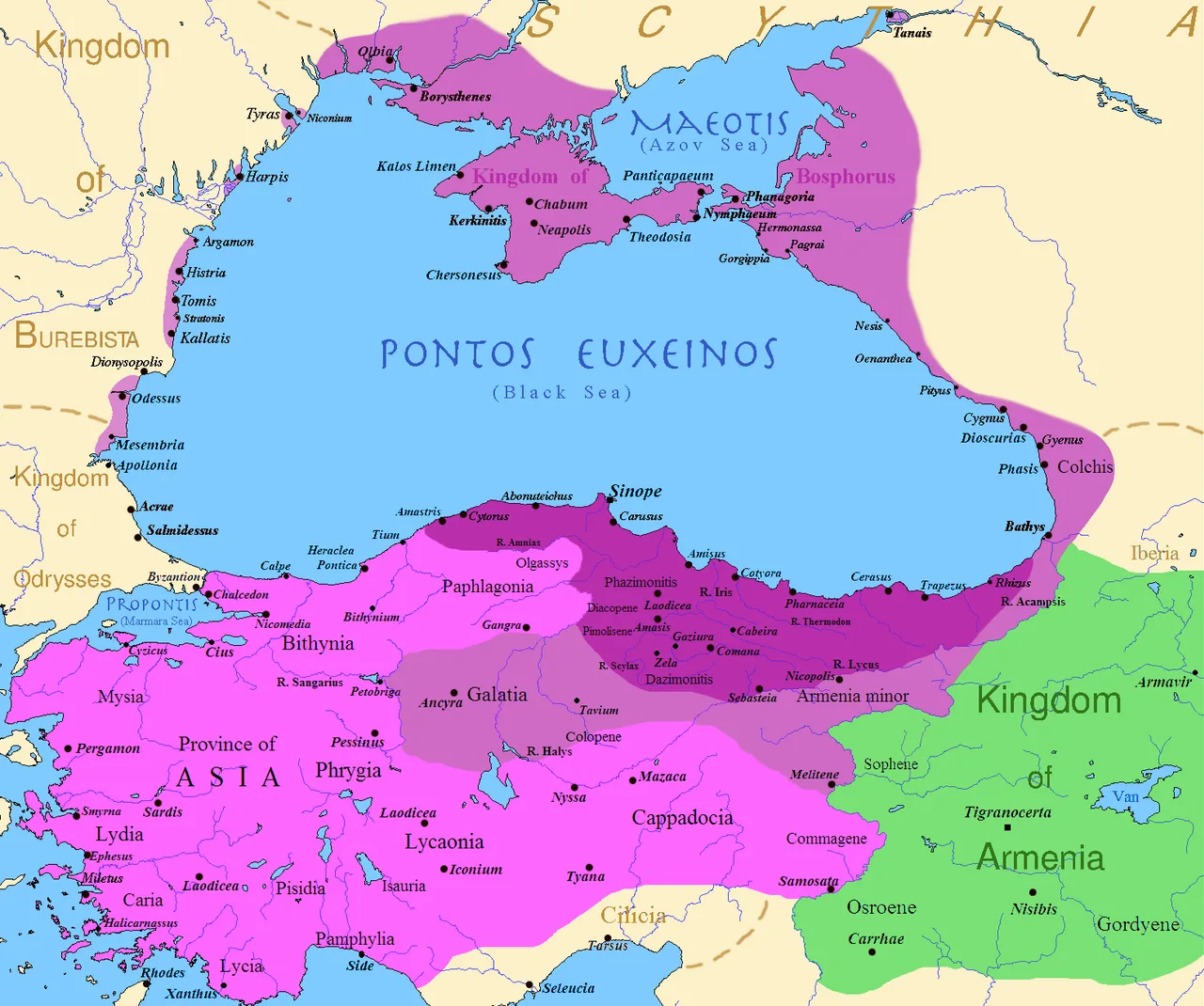
The Pontic empire at its height: before the reign of Mithridates VI (dark purple), after his early conquests (purple), and his conquests in the first Mithridatic Wars (pink)
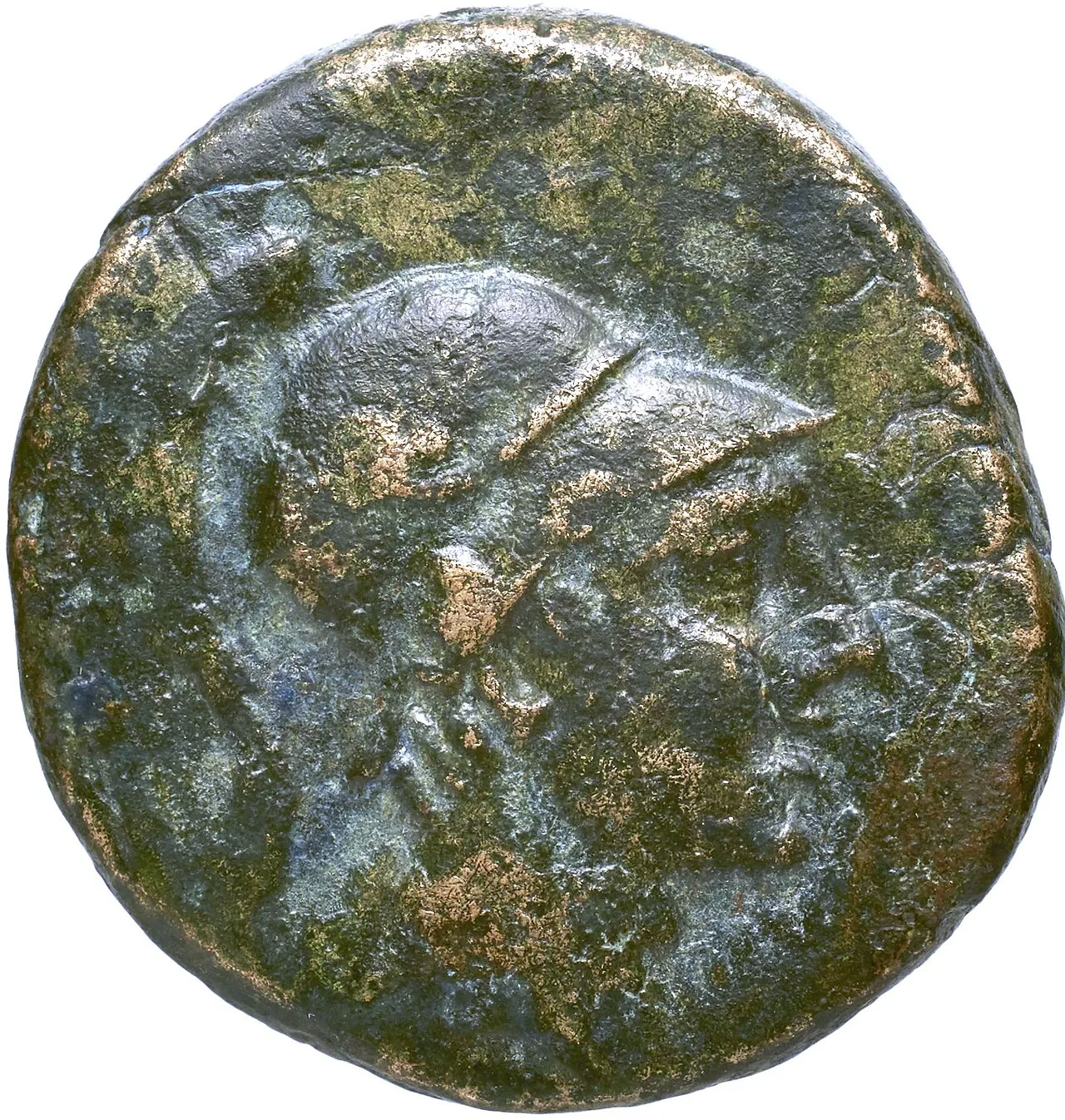
Coin of Pont Amisos

The Pontic Alps which divided the kingdom.
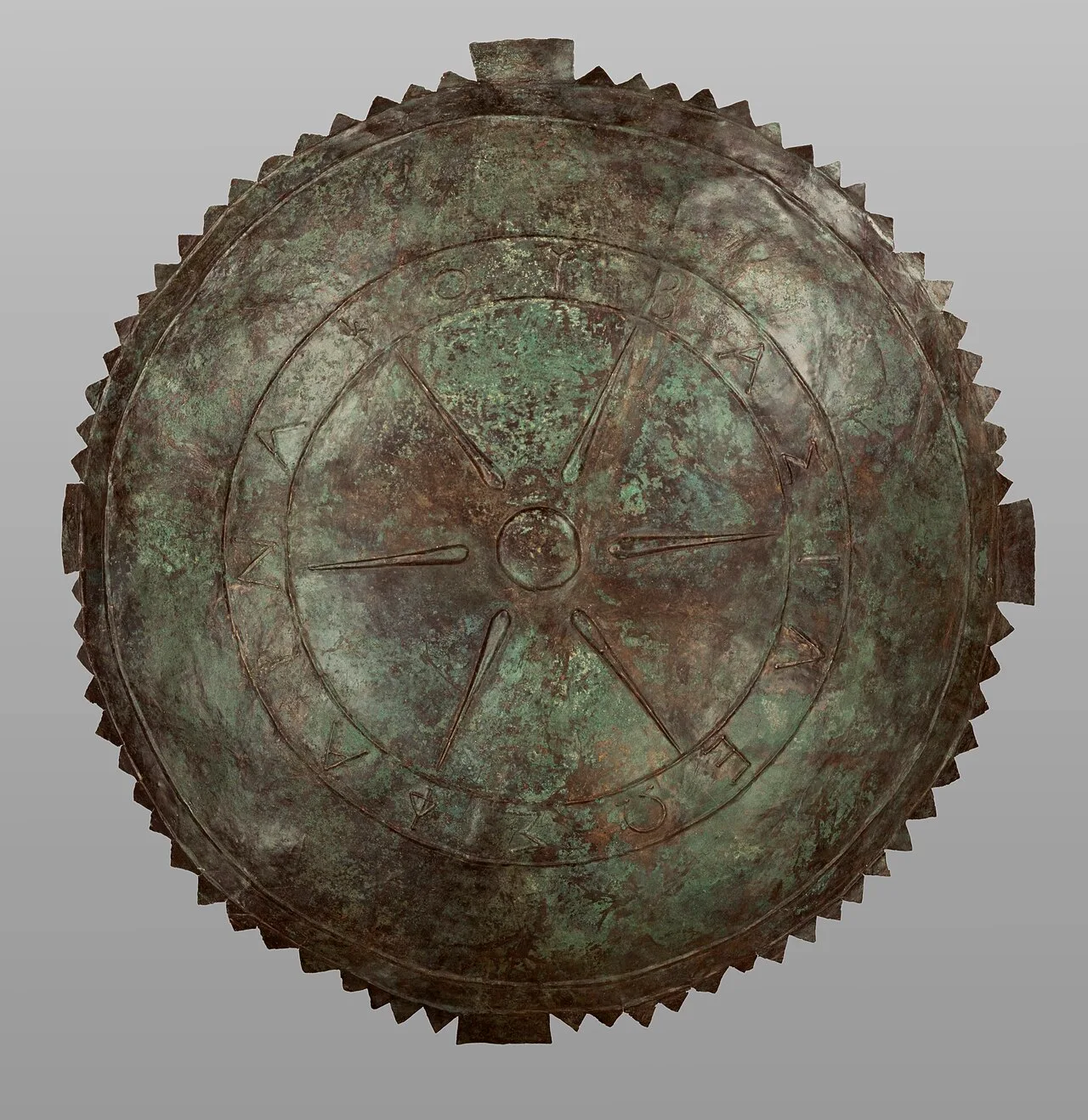
Bronze shield in the name of King Pharnakes: ΦΑΡΝΑΚΟΥ ΒΑΣΙΛΕΩΣ, Getty Villa (80.AC.60)
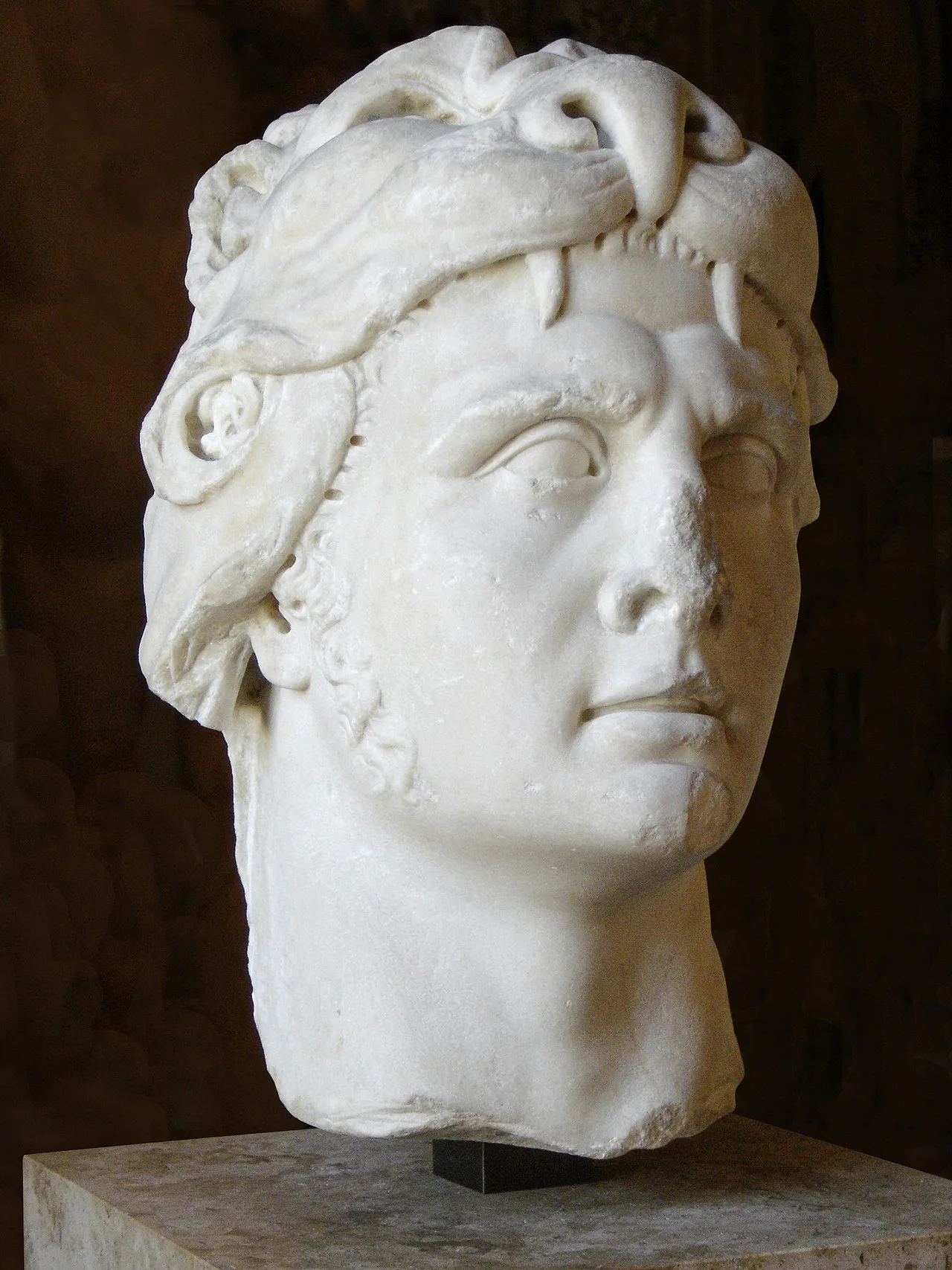
Bust of Mithridates VI from the Louvre
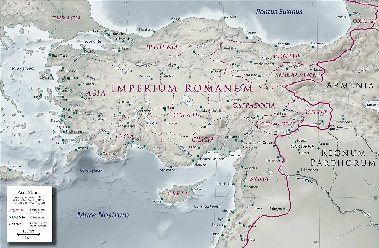
Anatolia in the early 1st century AD with Pontus as a Roman client state
Kingdom of Pontus
Pontus was a Hellenistic kingdom in northern Anatolia on the southern coast of the Black Sea. Ruled by the Mithridatic dynasty, it existed from 281 BC until its conquest by the Roman Republic in 63 BC.
A Six-Horseman Escape to Crown a King
The royal lineage began under perilous circumstances when Antigonus executed Mithridates II in 302 BC. Forewarned by Demetrius I, his son fled east with only six horsemen into Paphlagonia and Cappadocia. From these modest beginnings, he fought Seleucus I and declared himself king in 281 BC.
From Wikipedia · CC BY-SA 4.0
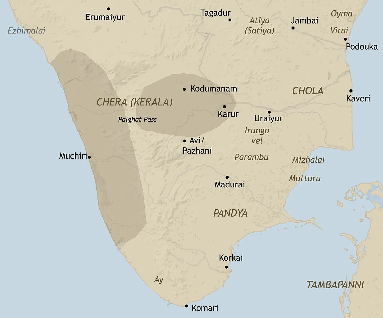
Approximate extent of Chera influence in early historic south India (Gurukkal, 2002)
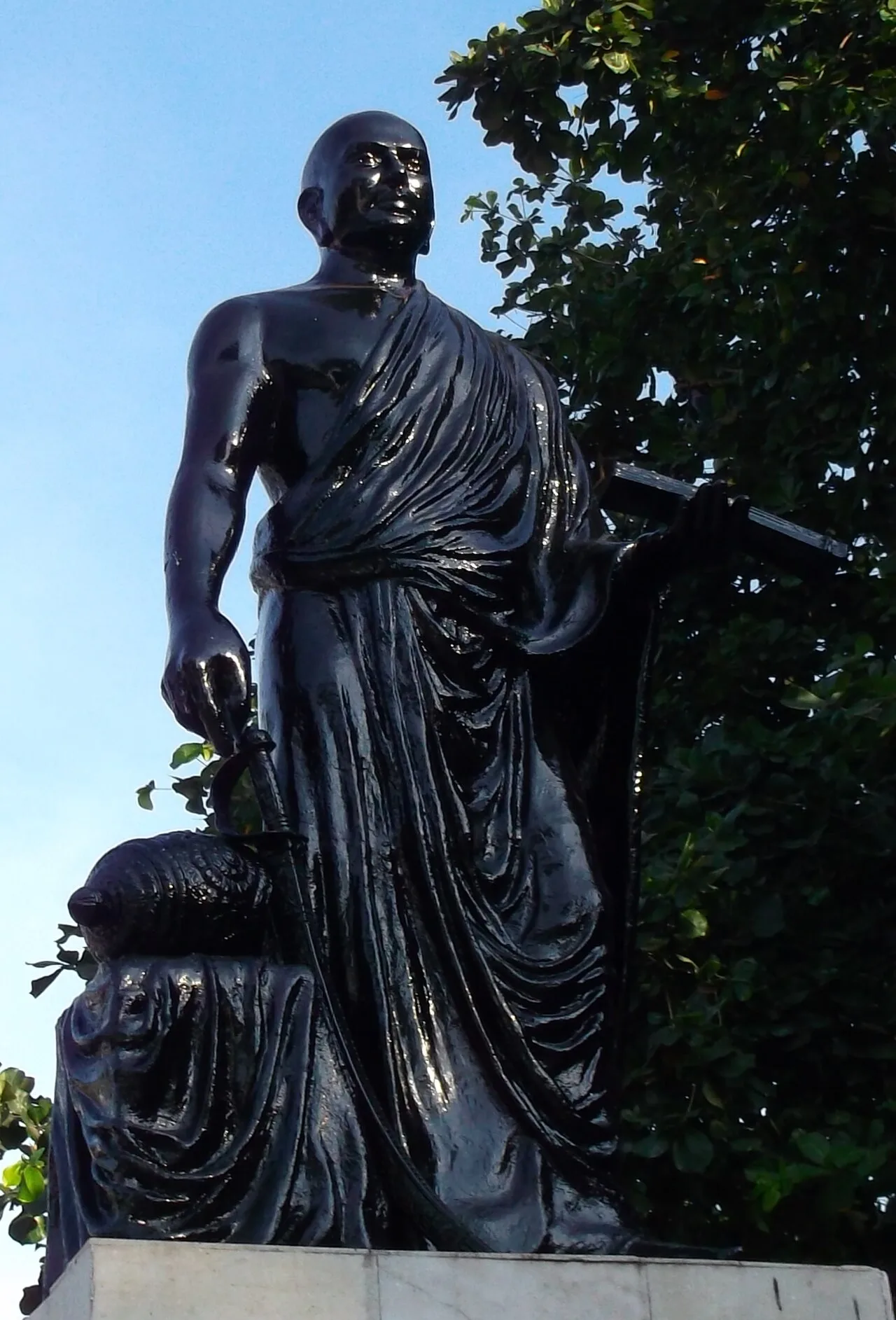
Ilango Adigal, a 2nd-century Chera prince and Jain monk, is credited with composing the Tamil epic Silappatikaram.
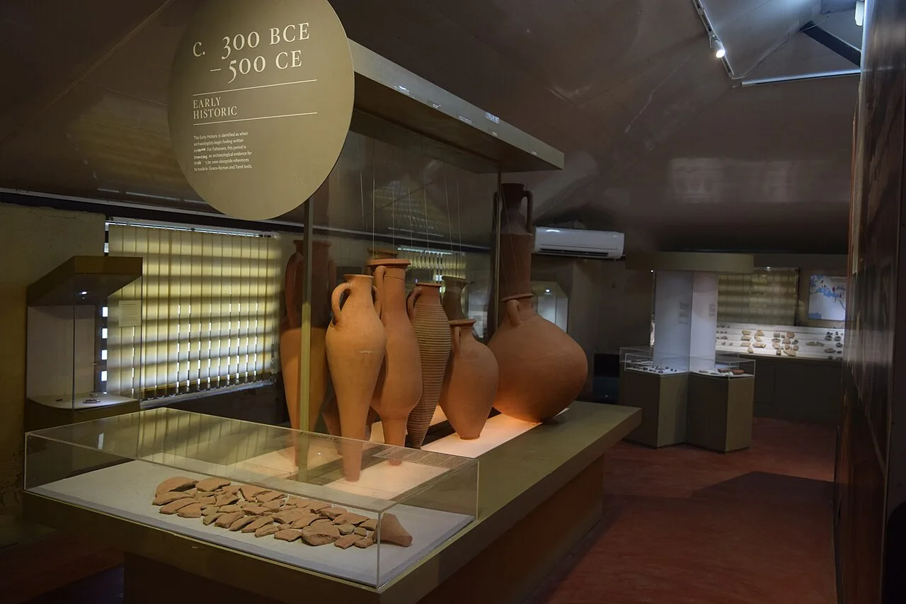
Amphorae sherds found at Pattnanam excavation site (Kerala).
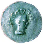
A Chera coin with legend "Kuttuvan Kotai"
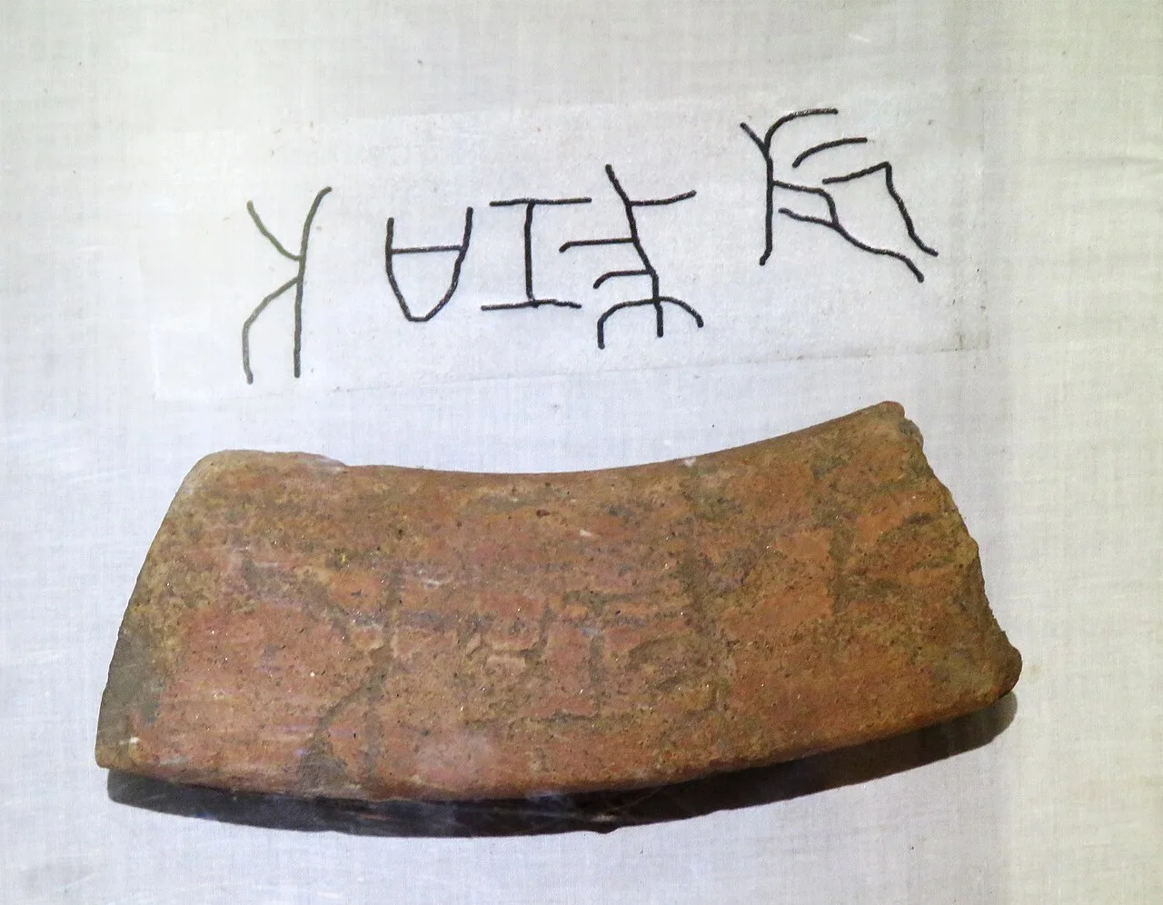
Brahmi Inscription (with graffiti "sramana"), Pattanam
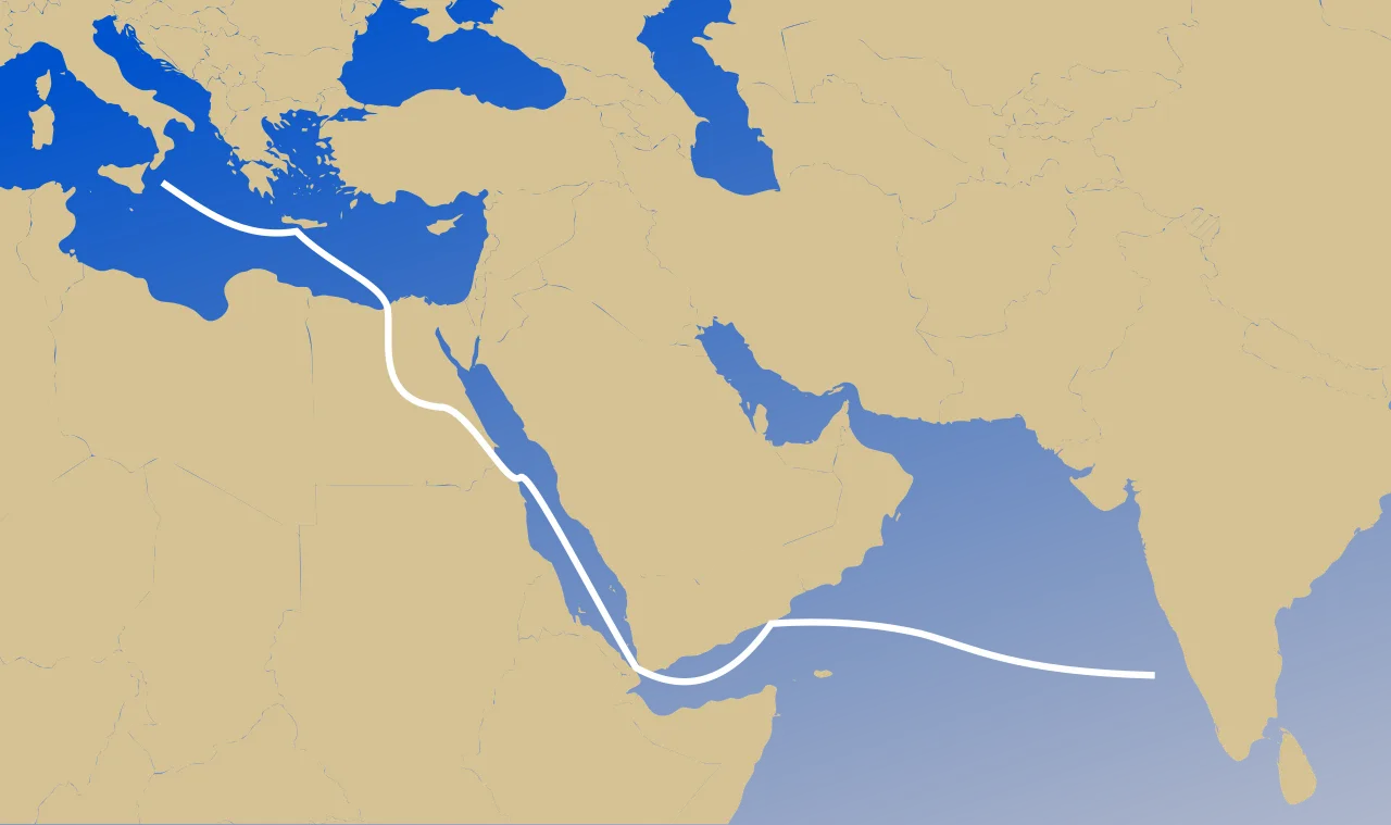
Mediterranean/Middle East to India Route
Chera dynasty
The Chera dynasty, an early historic dynasty of southern India, ruled parts of present-day Kerala and Tamil Nadu and was one of the Three Crowned Kings of Tamilakam.
Classical Corruptions of Royal Names
Mediterranean writers documented southern Indian polities through foreign transcriptions of local titles. Pliny the Elder in the 1st century CE recorded the Cheras of southern India as "Kaelobotros", while the Periplus Maris Erythraei noted them as "Keprobotras". Claudius Ptolemy later recorded them as "Kerobottros" in the 2nd century CE. These external accounts reflect how Indian Ocean navigation networks carried dynastic names across the classical world.
From Wikipedia · CC BY-SA 4.0

Location of Nanyue at its greatest extent
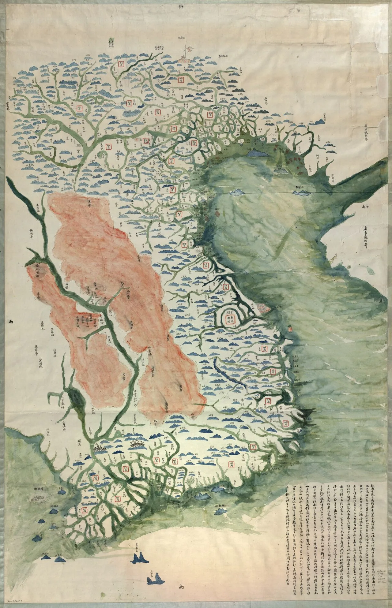
Việt Nam toàn cảnh dư đồ (越南全境輿圖) là bản đồ Dại Nam chú giải bằng chữ Hán
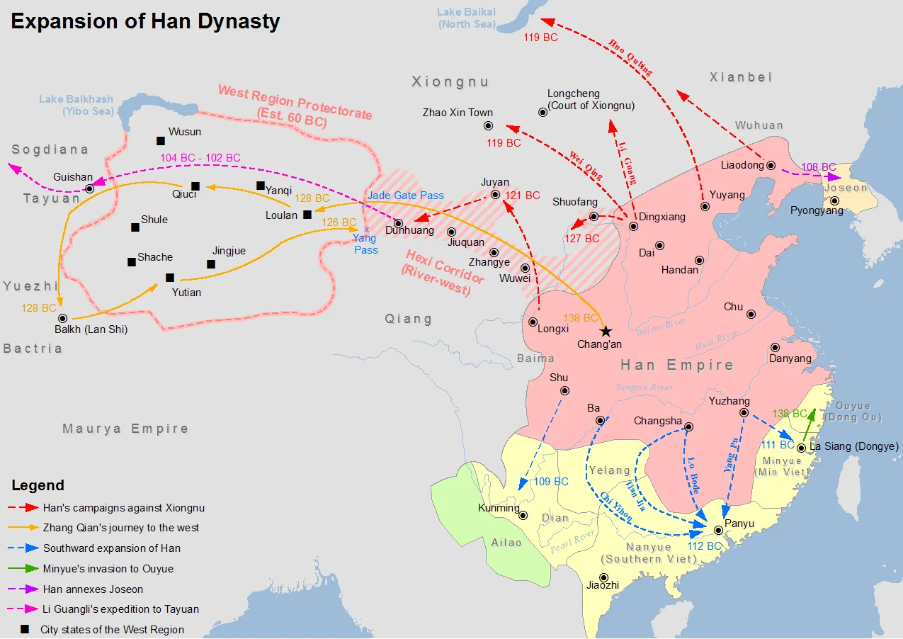
Map showing the expansion of Han dynasty in the 2nd century BC
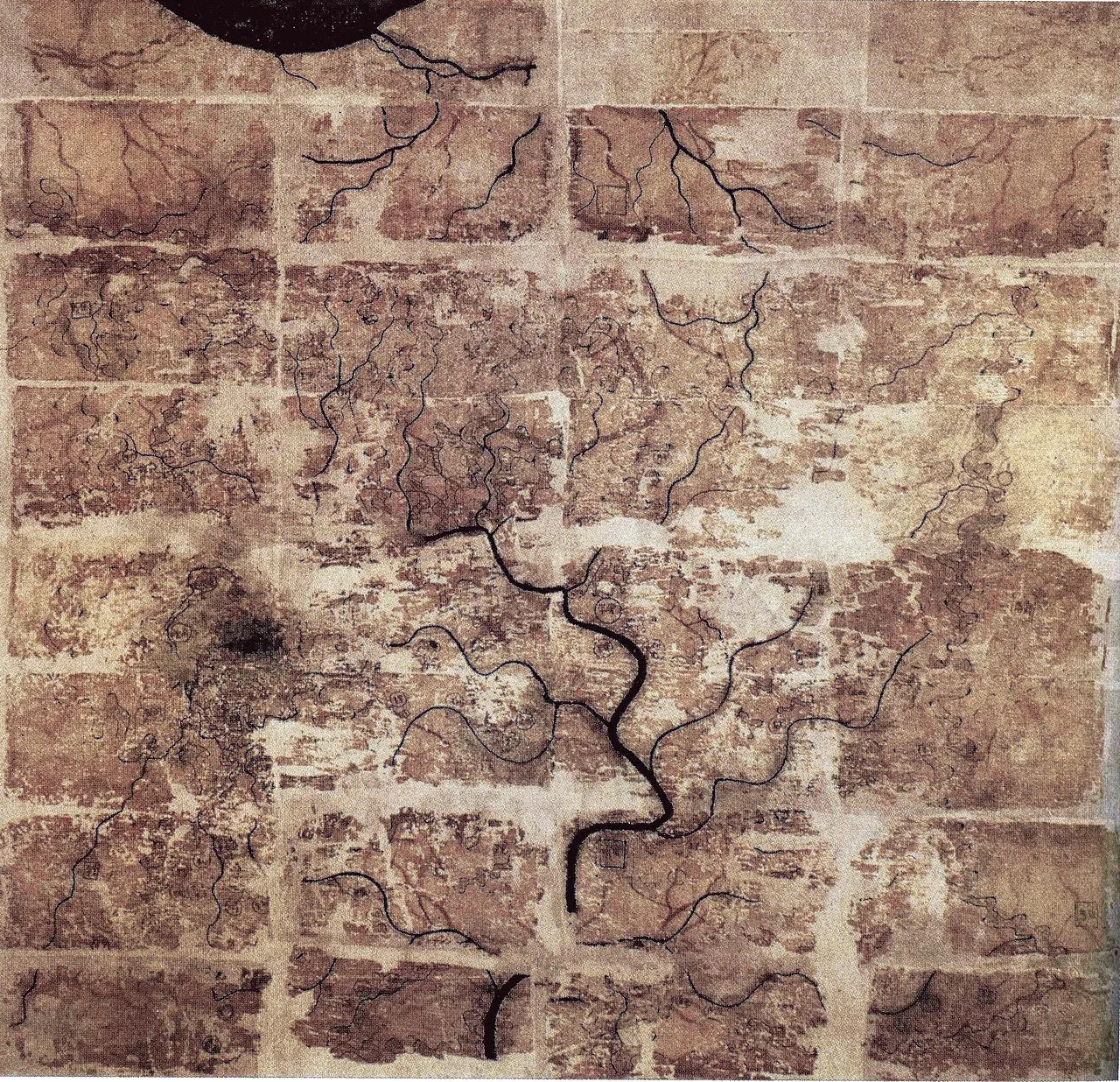
An early Western-Han silk map found in Tomb 3 of Mawangdui Han tombs site, depicting the Kingdom of Changsha and Kingdom of Nanyue (note: the south direction is oriented at the top).
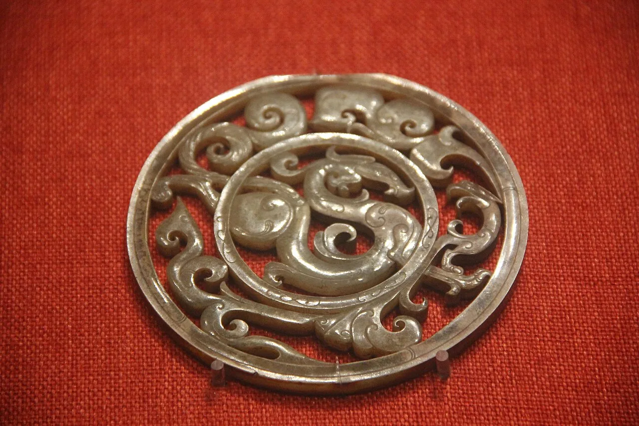
Jade Openwork Disk with Dragon and Phoenix
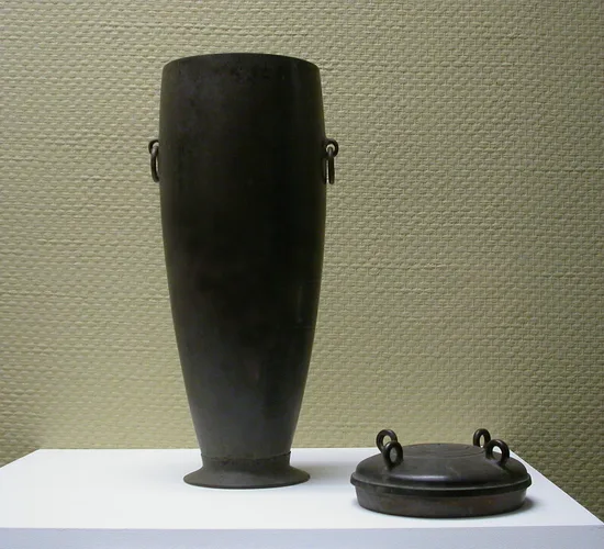
Bronze wine vessel
Nanyue
Nanyue was an ancient kingdom founded in 204 BC by the Chinese general Zhao Tuo, whose family continued to rule until 111 BC.
General Zhao Tuo's Opportunistic Post-Qin Secession
Following the sudden collapse of the Qin dynasty, general Zhao Tuo established Nanyue in 204 BC from former southern commanderies. This decisive strategic maneuver effectively shielded the southern territories from the widespread chaos and hardship gripping the north. Operating as an autonomous realm, the dynastic state lasted 93 years and had five generations of monarchs, establishing independent regional power while preserving northern bureaucratic models.
From Wikipedia · CC BY-SA 4.0
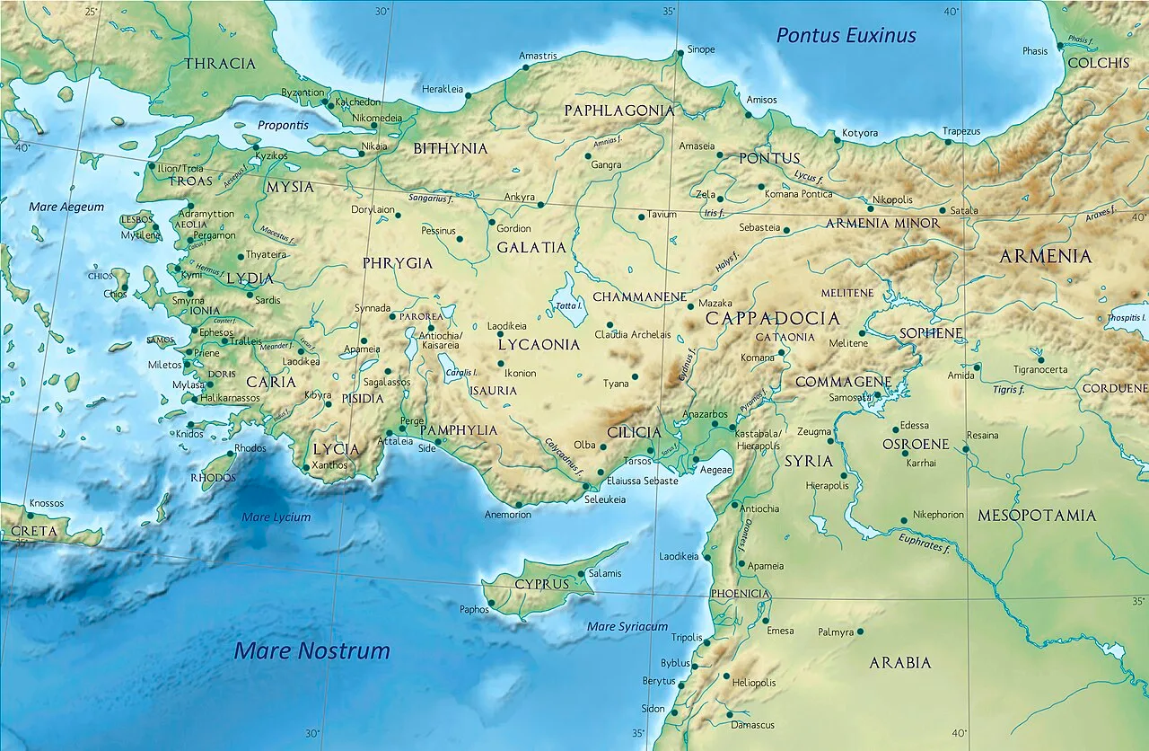
Asia Minor in the Greco-Roman period - general map - regions and main settlements
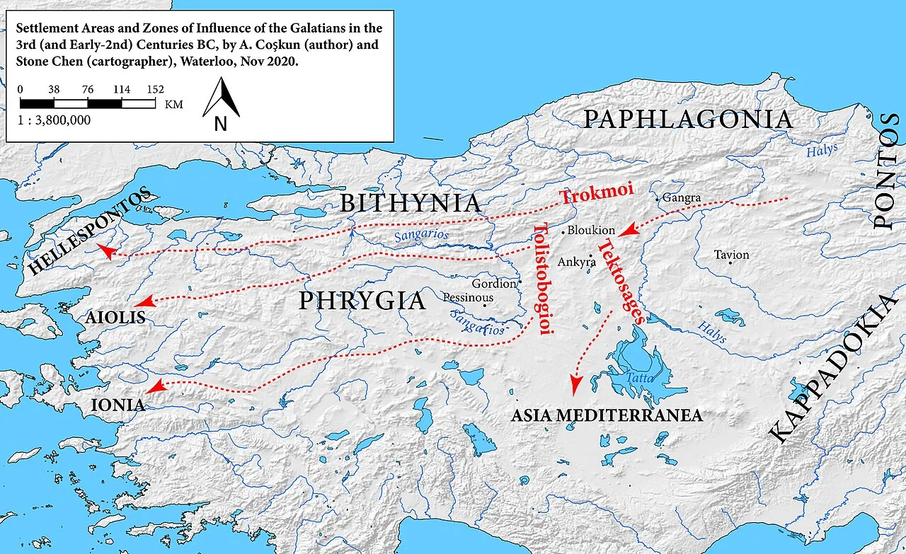
Areas of Galatian settlement in the 3rd and early 2nd centuries BC
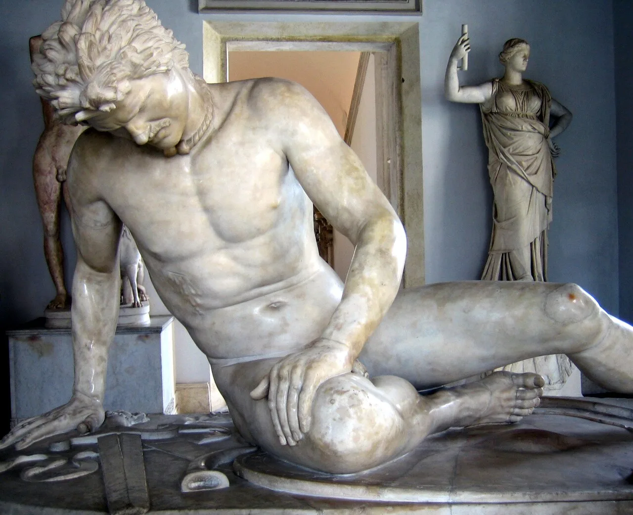
The Dying Gaul, Capitoline Museums, Rome
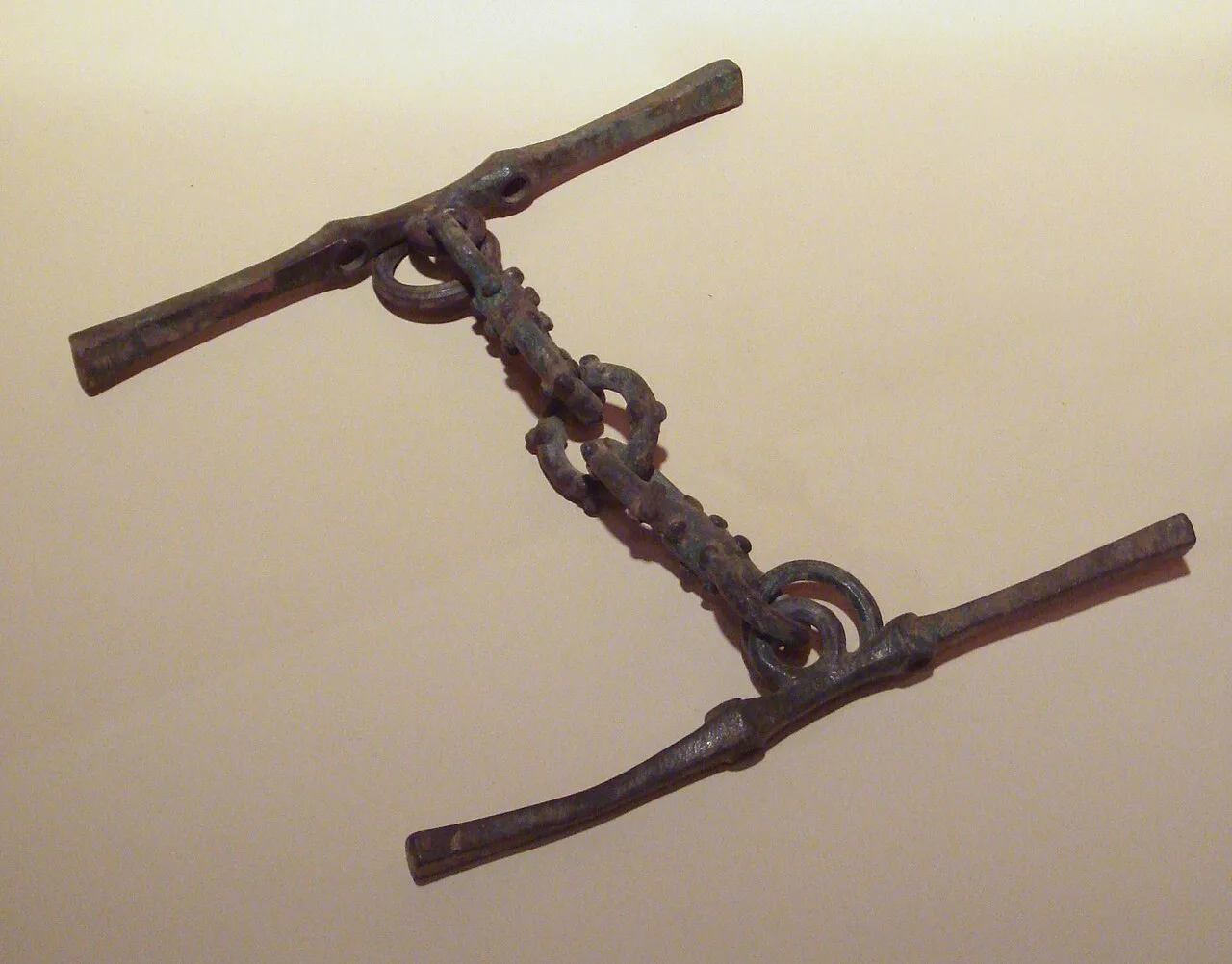
Galatian bronze horse bit, 3rd century BC, Hidirsihlar tumulus, Bolu. Istanbul Archaeological Museum.

Galatian torcs, 3rd century BC, Hidirsihlar tumulus, Bolu. Istanbul Archaeological Museum.
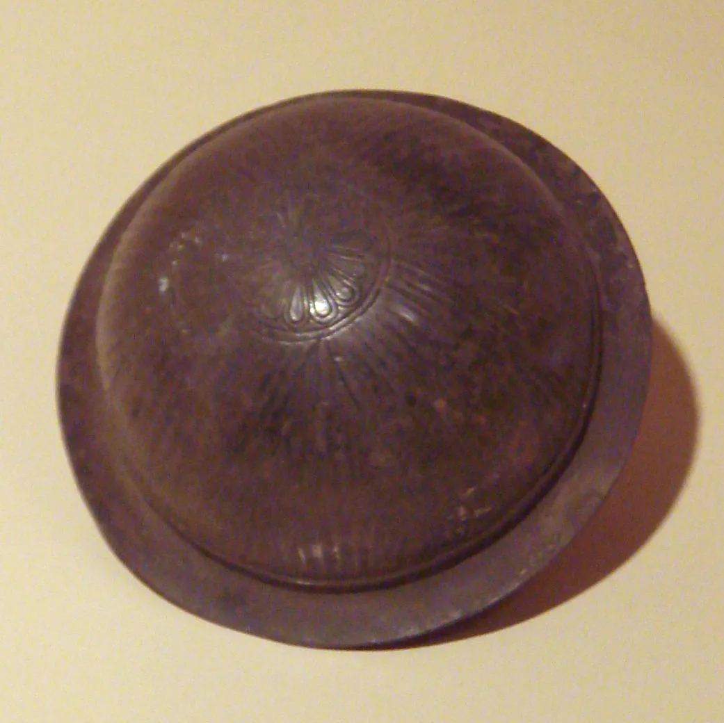
Galatian object, 3rd century BC, Hidirsihlar tumulus, Bolu. Istanbul Archaeological Museum.
Galatia
Galatia was an ancient area in the highlands of central Anatolia, roughly corresponding to the provinces of Ankara and Eskişehir in modern Turkey.
Twenty Thousand Hired Swords Slipping Bithynian Control
A royal conflict between Nikomedes I of Bithynia and his brother Zipoetes II brought 20,000 Galatian mercenaries across the straits. Divided into two distinct forces, these warriors crossed the Bosporus and Hellespont under the leadership of Leonnorius and Lutarius. This mercenary deployment permanently altered the regional balance of power, as the Celtic fighters quickly established an enduring autonomous presence rather than returning home.
From Wikipedia · CC BY-SA 4.0