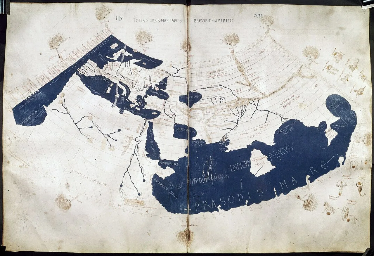
Ptolemy's world map, reconstituted from Ptolemy's Geography (circa 150) in the 15th century, indicating "Sinae" (China) at the extreme right, beyond the island of "Taprobane" (Ceylon or Sri Lanka, oversized) and the "Aurea Chersonesus" (Southeast Asian peninsula)
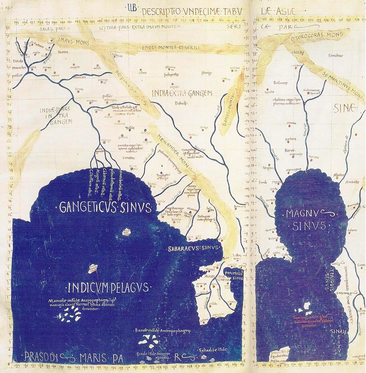
Detail of East and Southeast Asia in Ptolemy's world map. Gulf of the Ganges (Bay of Bengal) left, Southeast Asian peninsula in the center, South China Sea right, with "Sinae" (China)
Ptolemy's world map
The Ptolemy world map depicts the world known to Greco-Roman societies in the 2nd century, based on descriptions in Ptolemy's Geography.
Terrestrial Positioning via Sky Observations Fades into Obscurity
Ptolemy's work introduced terrestrial coordinates derived from sky observations to define global positions. Translating the treatise into Arabic during the 9th century enabled the scholar al-Khwārizmī to build upon it before the text faded into obscurity. This coordinate framework eventually transformed European cartography by introducing mathematical rigor to global spatial representation.
From Wikipedia · CC BY-SA 4.0
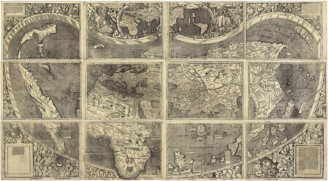
Universalis Cosmographia, the Waldseemüller wall map dated 1507, depicts America, Africa, Europe, Asia, and the Oceanus Orientalis Indicus separating Asia from the Americas.
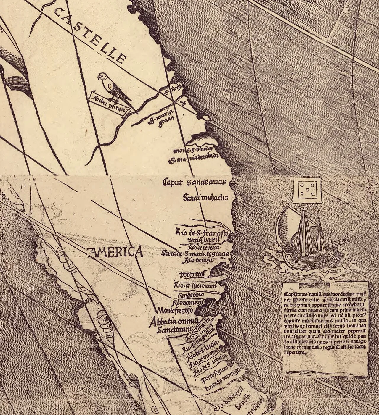
Detail of the map showing the name "America". The inscription under the ship (translated) says : "This land appeared here to the captain [ Cabral ] of the fourteen ships sent from Portugal to Calicut by the King: it was thought to be mainland [i.e. part of Asia] although, together with the previously discovered part, it is an enormous sea-girt island of yet unknown size [i.e. not part of Asia], in which both sexes, male and female, are used to going about no otherwise than as their mothers bore them. And in fact here they are somewhat lighter-skinned than those found on an earlier expedition under the command of the King of Castile."[1]
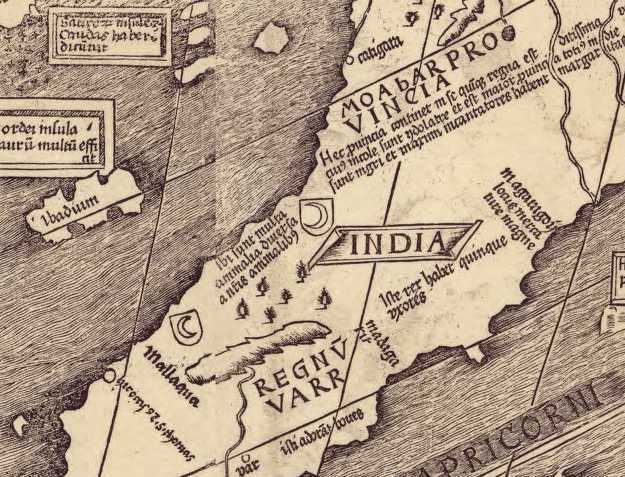
Detail of the map showing the names "Catigara" and "Mallaqua" where "was slain St. Thomas".
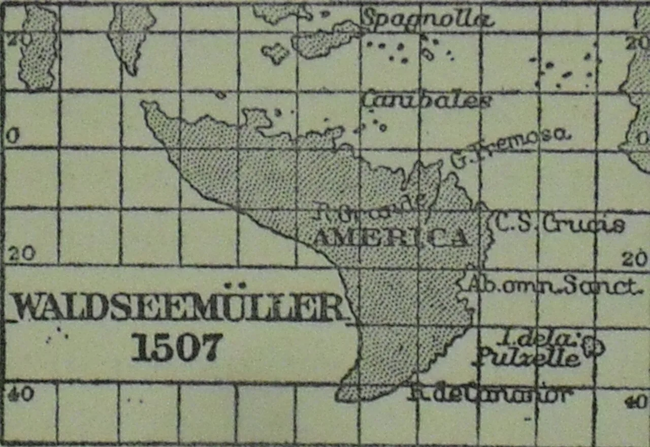
Waldseemüller's 1507 map of America re-drawn on an equirectangular projection and on the same uniform scale as that of Schöner of 1515, so as to be readily comparable.[7]
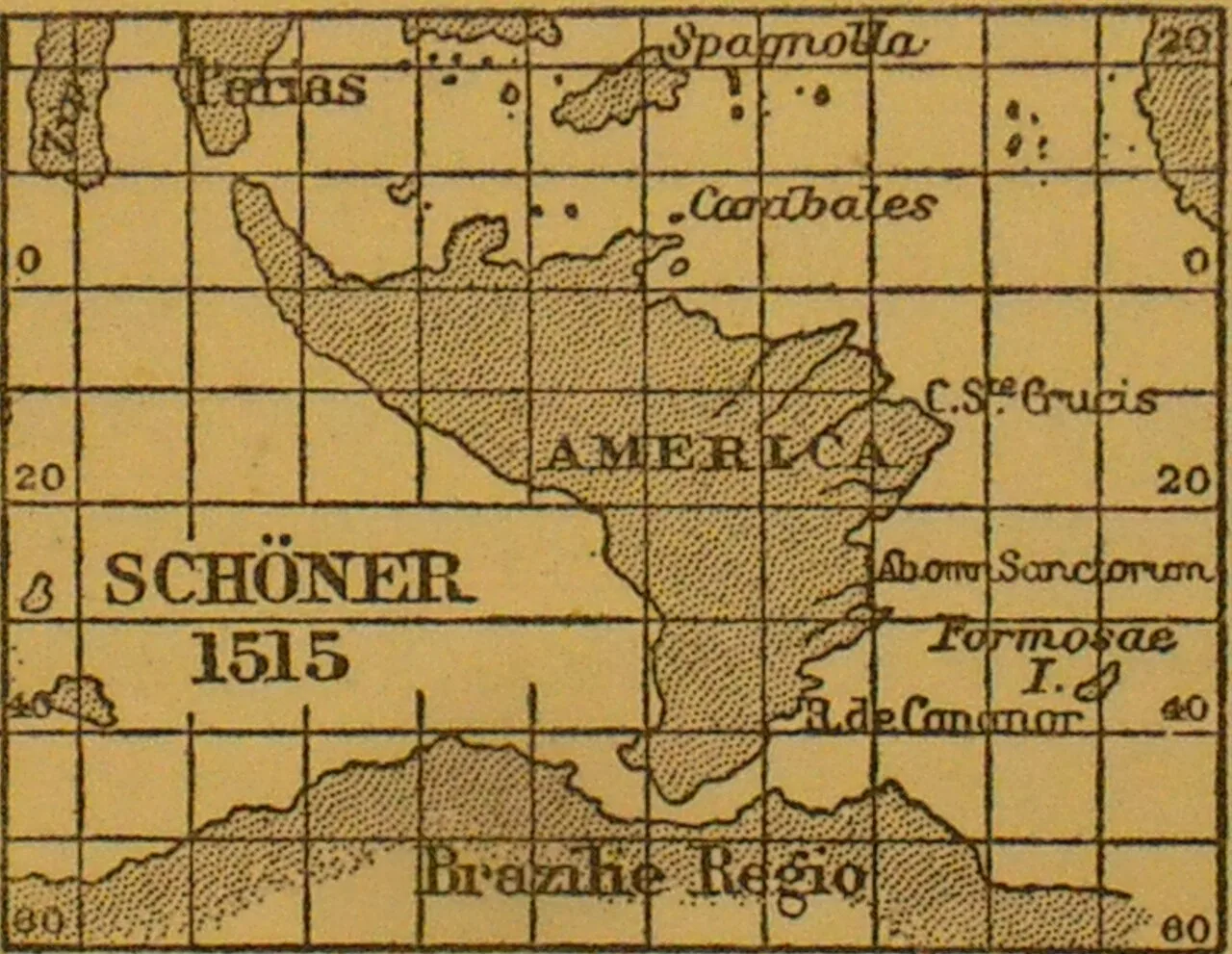
Schöner's 1515 map of America re-drawn on an equirectangular projection and on the same uniform scale as that of Waldseemüller of 1507, so as to be readily comparable.[7]
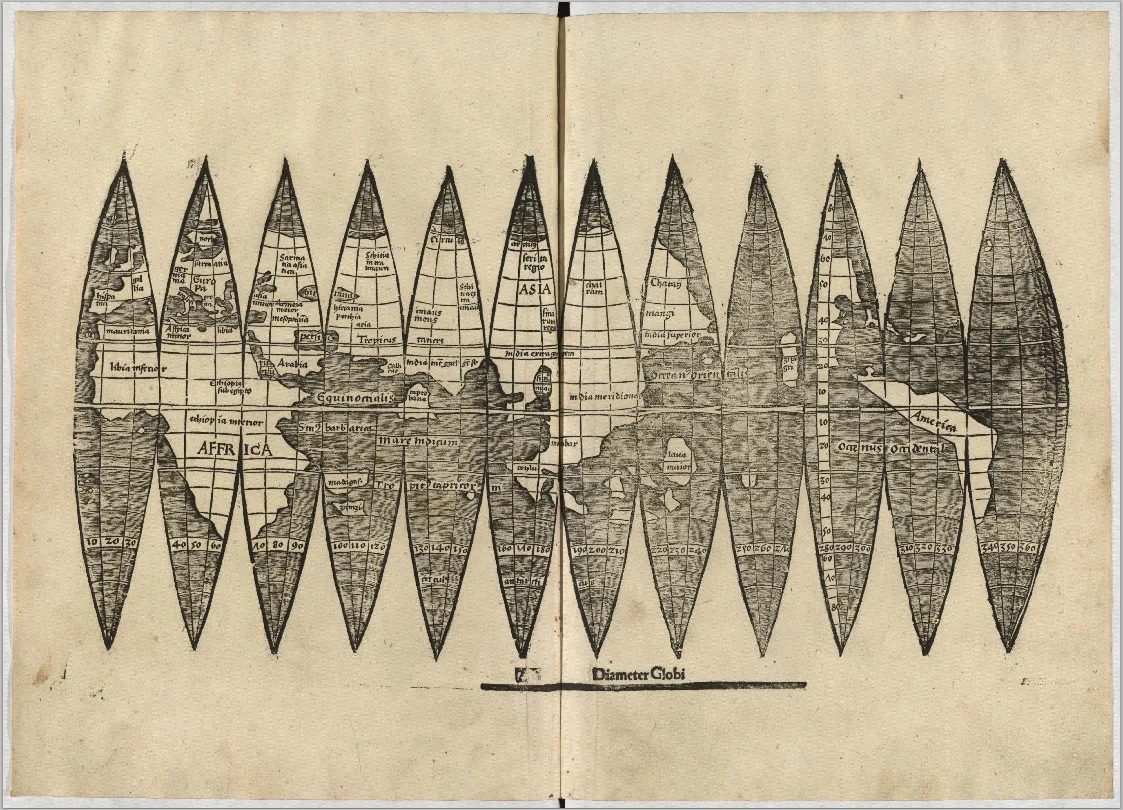
Globe gore version found at LMU Munich in 2012
Waldseemüller map
The Waldseemüller map is a 1507 world wall map by Martin Waldseemüller, notable as the first map to use the name America.
Mapping an Ocean Before Its Discovery
Martin Waldseemüller mapped the Pacific Ocean half a decade before any European navigator laid eyes on it. Vasco Núñez de Balboa became the first recorded European to see this vast ocean in 1513. That is five to six years after Waldseemüller made his map. Rather than relying on physical exploration, the cartographer used theoretical leaps to separate the newly discovered landmass from Asia.
From Wikipedia · CC BY-SA 4.0
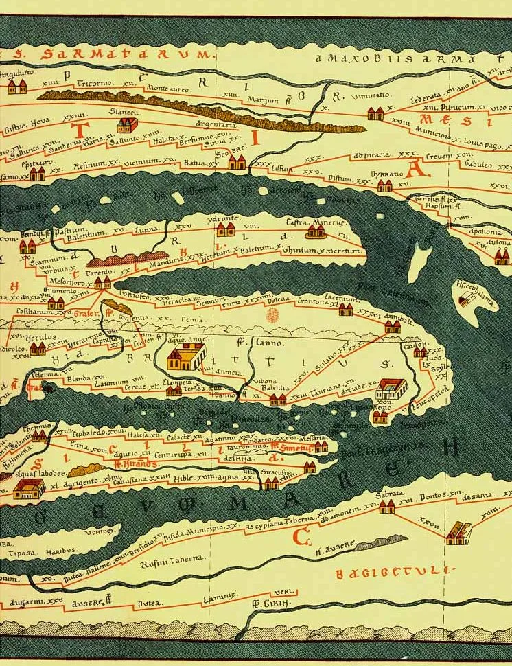
Tabula Peutingeriana (section of a modern facsimile), top to bottom: Dalmatian coast, Adriatic Sea, southern Italy, Sicily, African Mediterranean coast
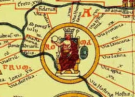
Rome (from a facsimile)

TabulaPeutingeriana
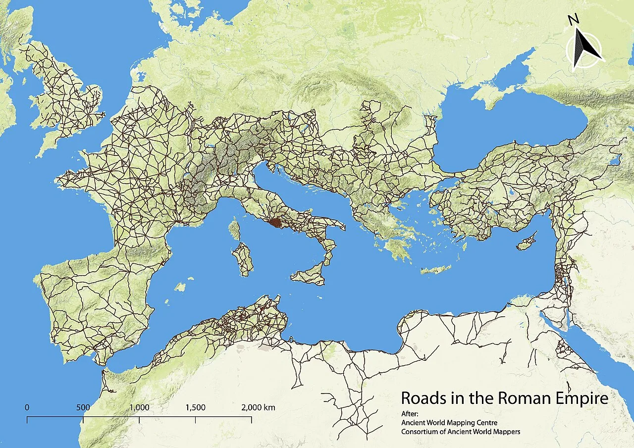
Combined data from the Peutinger Table and Antonine Itinerary recording the Roman roads network.
Tabula Peutingeriana
The Peutinger Table is an illustrated ancient Roman road map showing the layout of the cursus publicus, the road network of the Roman Empire.
Volcanic Destruction Anchoring Ancient Dates
The map features the Roman town of Pompeii near modern-day Naples, which was never rebuilt after its destruction in an eruption of Mount Vesuvius in AD 79. This inclusion provides vital chronological evidence for dating the original cartographic source. American historian Glen Bowersock supported an early imperial dating for the archetype based on this detail alongside anachronistic elements of Roman Arabia.
From Wikipedia · CC BY-SA 4.0

Turin Papyrus (geological map) - Museo Egizio Turin C 1879 1969 1899 p01
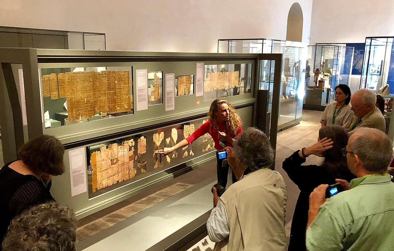
The Turin Papyrus Map on display at the Museo Egizio in 2019.
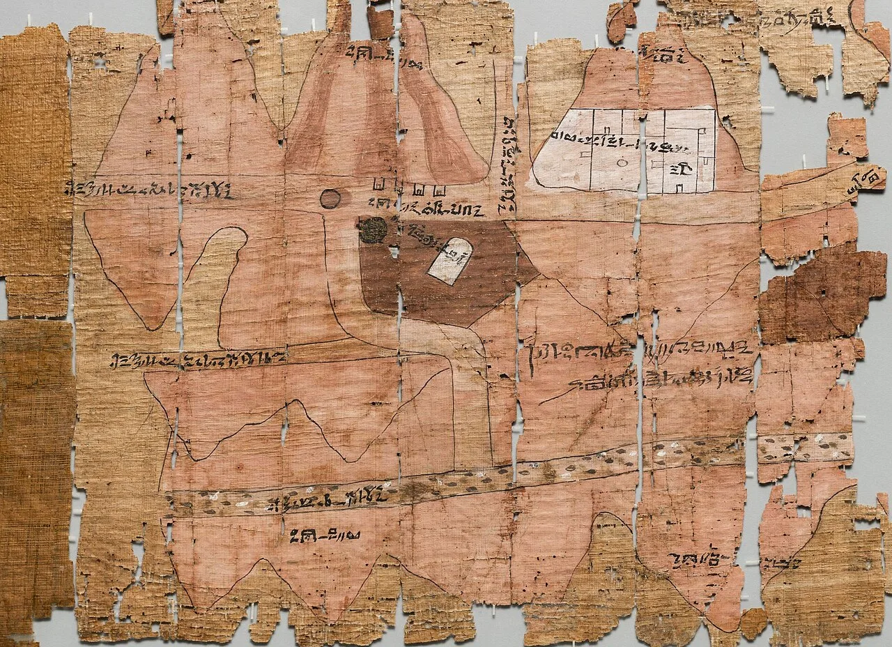
Detail of the map

Verso of the Turin Papyrus Map, with several hieratic texts.
Turin Papyrus Map
The Turin Papyrus Map is an ancient Egyptian map from around 1150 BCE, considered the oldest surviving topographical map from the ancient world.
South-Up Alignment and Straightened Curves
Ancient cartographers did not default to north-up orientation. The Turin Papyrus Map is oriented with south at the top, pointing toward the source of the Nile River. To fit the terrain onto a narrow scroll, the scribe deliberately straightened the actual bends of Wadi Hammamat rather than attempting a curved representation.
From Wikipedia · CC BY-SA 4.0
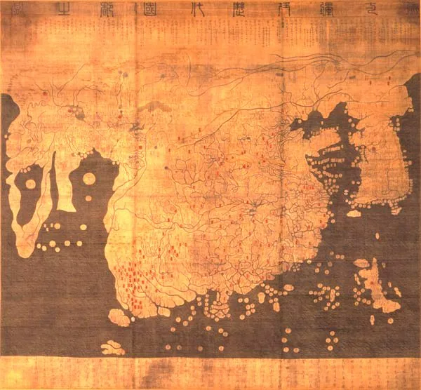
KangnidoMap
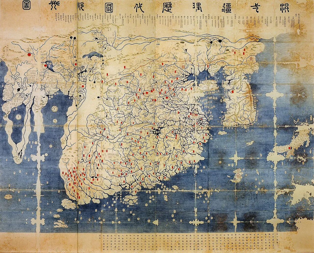
The later Honkōji version of the map.
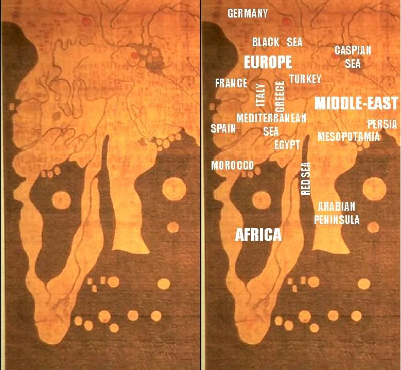
Details of Africa, Europe and the Middle East.
Kangnido
The Kangnido is a 1402 Korean world map created during the Joseon dynasty, notable as the oldest surviving Korean world map.
Islamic roots of Afro-Eurasian cartography in Joseon Korea
Completed in 1402 by Korean scholars, the Kangnido depicts the Old World from Europe to Japan using Afro-Eurasian geographical knowledge unavailable in pre-Mongol China. Islamic geographical information acquired via the Ilkhanate accurately placed over 100 European locations, including Alumangia for Germany. It also delineated about 35 African place names, including Misr for Cairo, well before Vasco da Gama's oceanic voyages.
From Wikipedia · CC BY-SA 4.0
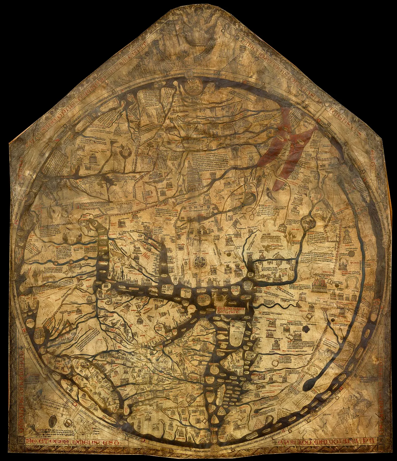
The Hereford mappa mundi, a map of the world with Jerusalem at its centre
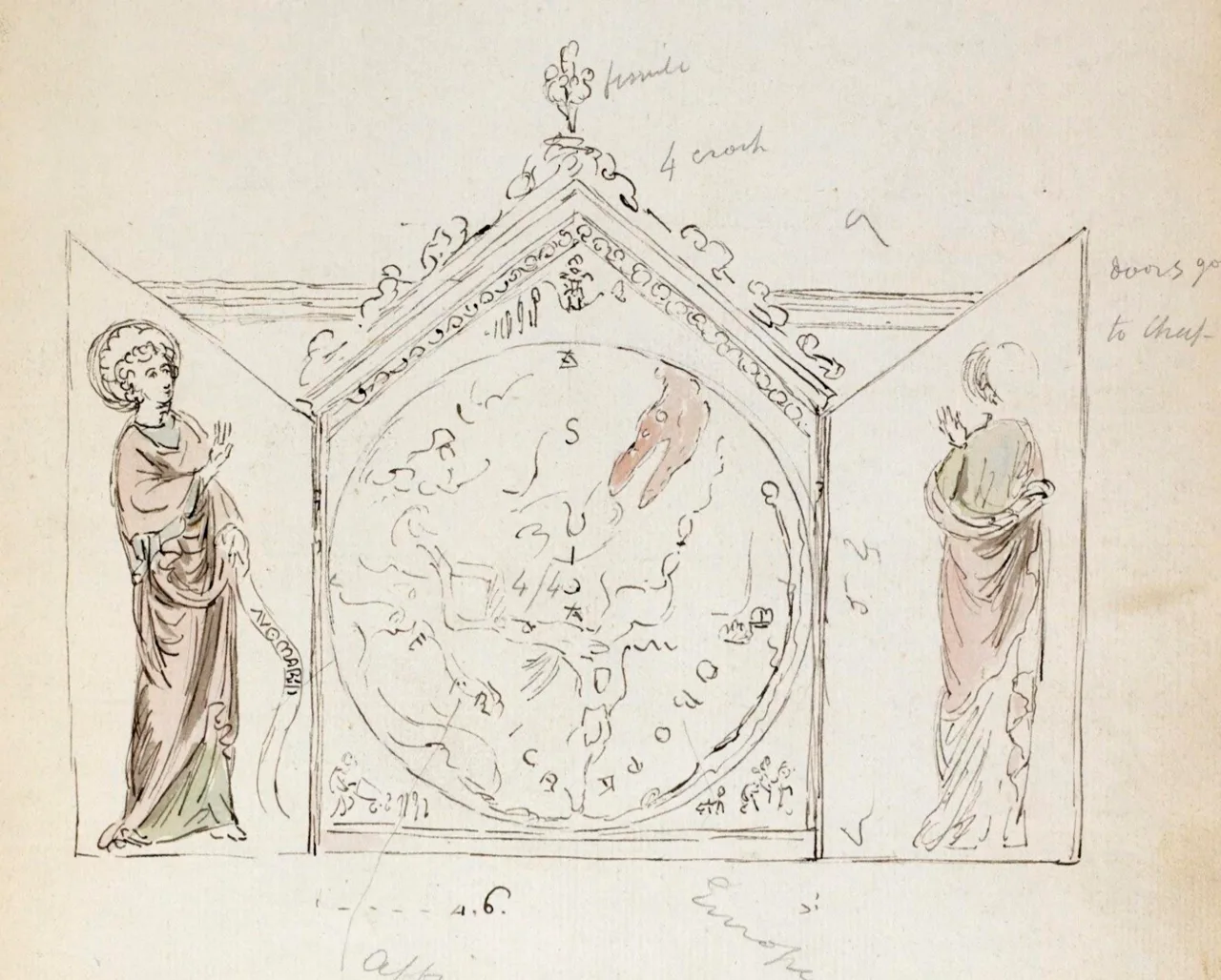
1784 sketch of the triptych containing the Hereford Mappa Mundi, showing side panels
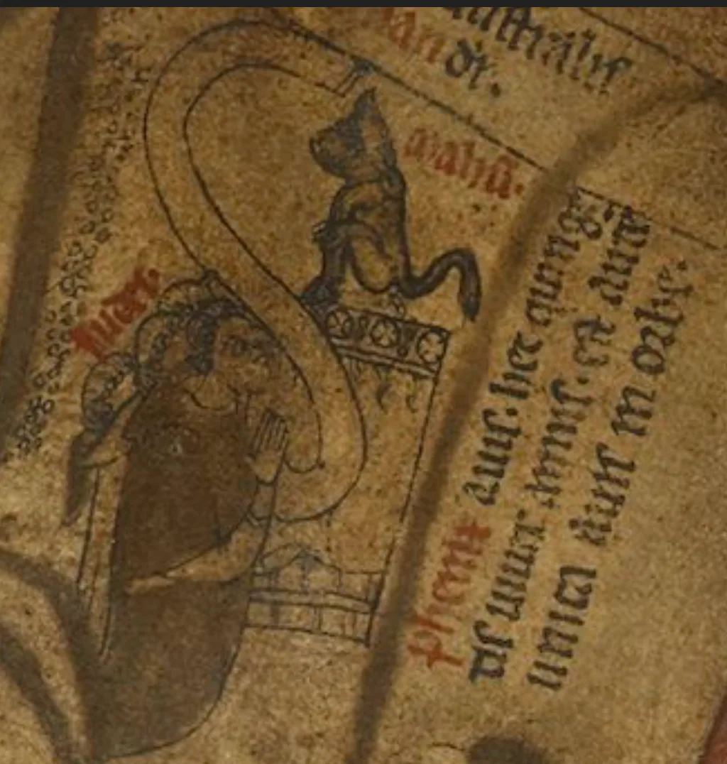
Jews worshipping the Golden Calf presented as a Mahun, or Saracen devil
![Locations on the Hereford mappa mundi[citation needed]](https://hmzpdsmr7uczkvx4.public.blob.vercel-storage.com/wikifeed/hereford-mappa-mundi/3-c0c2ef32e2.png)
Locations on the Hereford mappa mundi[citation needed]
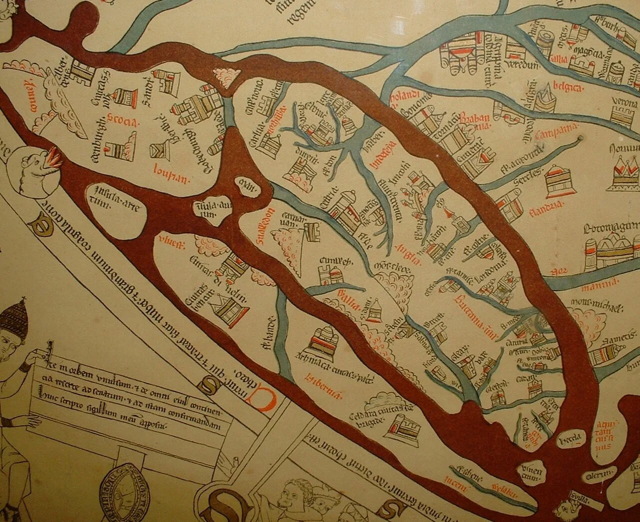
Detail showing the British Isles
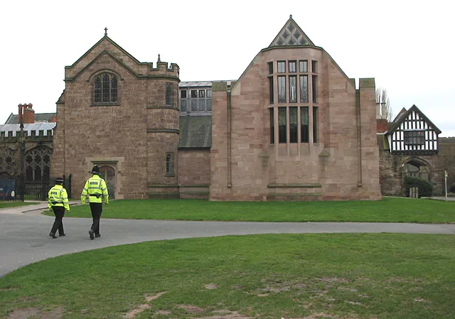
The new library at Hereford Cathedral, where the map is now housed
Hereford Mappa Mundi
The Hereford Mappa Mundi is the largest surviving medieval world map, offering a religious depiction of the known world that features heaven and hell.
A Round World inside a Round Frame
Modern viewers often mistake the circular T-O structure of medieval maps as evidence of a flat-Earth belief. In reality, the spherical shape of the Earth was already known to the ancient Greeks and Romans and was never entirely forgotten in the Middle Ages. Mapmakers utilized the circular representation as a conventional projection method rather than a literal planetary edge. This approach remained adequate because only the known parts of the Northern Hemisphere were believed to be inhabitable by human beings.
From Wikipedia · CC BY-SA 4.0
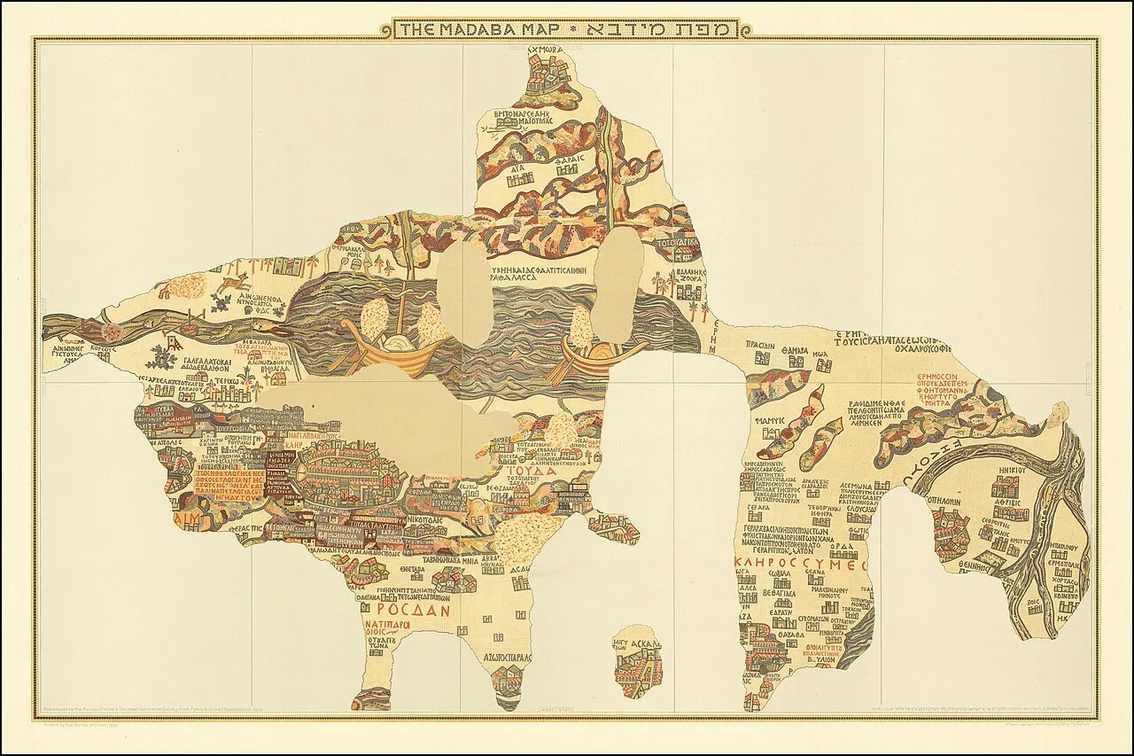
Annotated reproduction of the Madaba Map
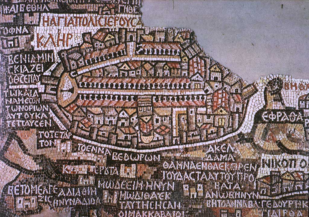
Jerusalem on the Madaba Map
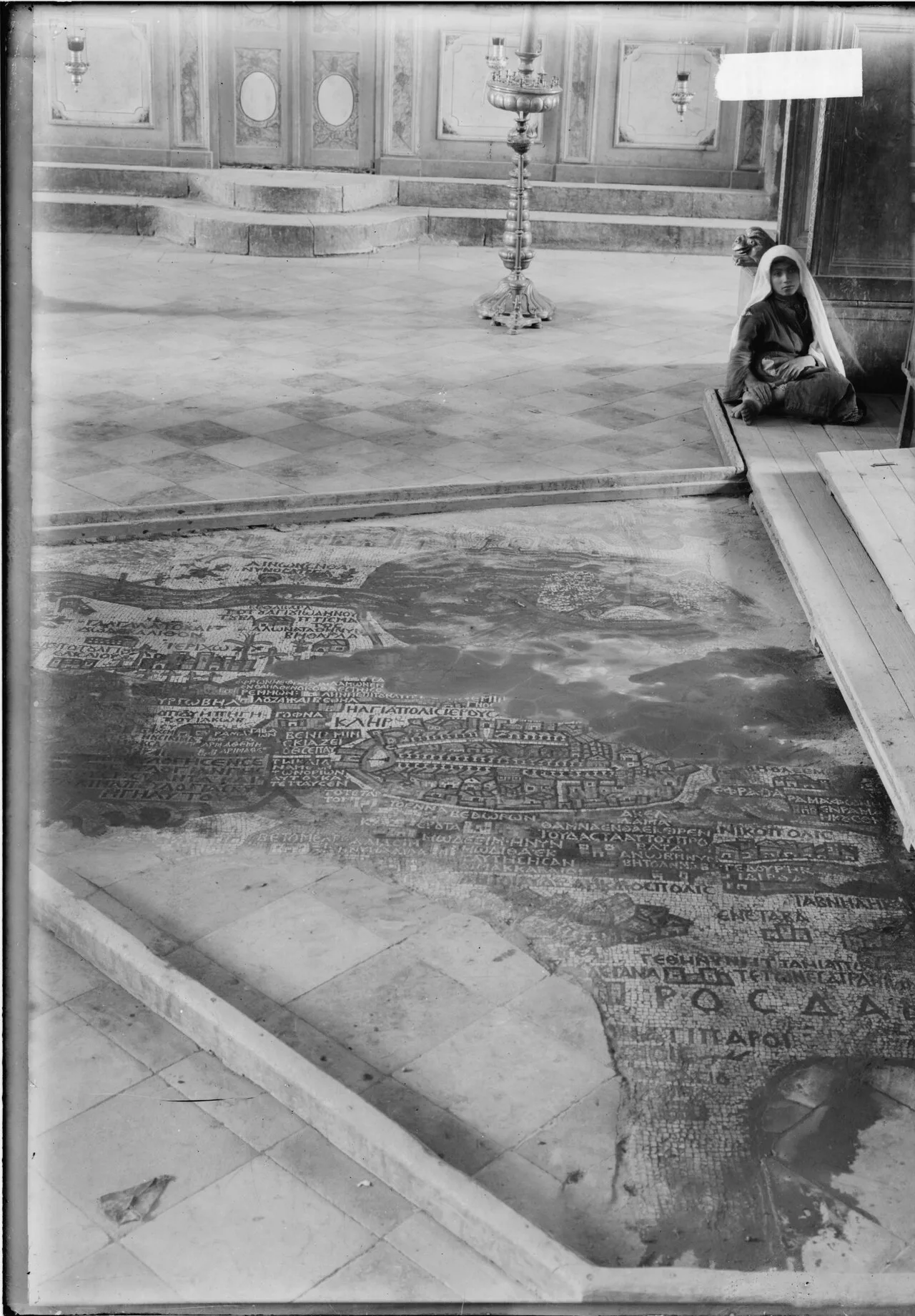
The newly rediscovered mosaic inside the modern Orthodox church (cropped from original stereogram)
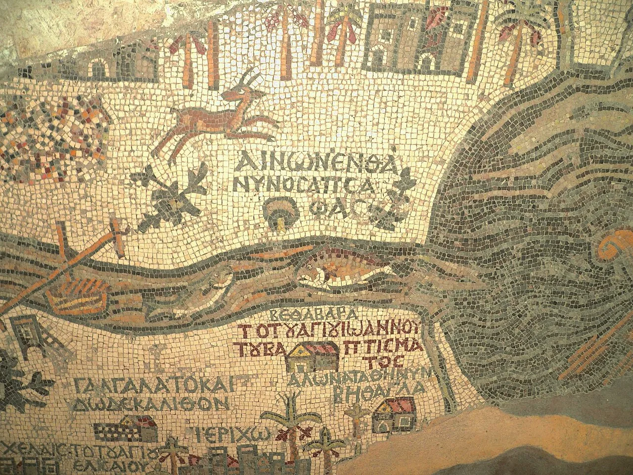
Place of John the Baptist's baptism at the mouth of the Jordan and a (nearly-obliterated) lion hunting a gazelle
Madaba Map
The Madaba Map, also known as the Madaba Mosaic Map, is part of a floor mosaic in the early Byzantine church of Saint George in Madaba, Jordan.
Pinpointing Creation Through Absent Architecture
Rather than bearing an explicit creation date, the mosaic reveals its age through urban additions and omissions. The artwork depicts Jerusalem alongside the New Church of the Theotokos, which was dedicated on 20 November 542. Because buildings erected in Jerusalem after 570 are absent from the depiction, scholars are able to limit the date range of its creation precisely to the period between 542 and 570.
From Wikipedia · CC BY-SA 4.0
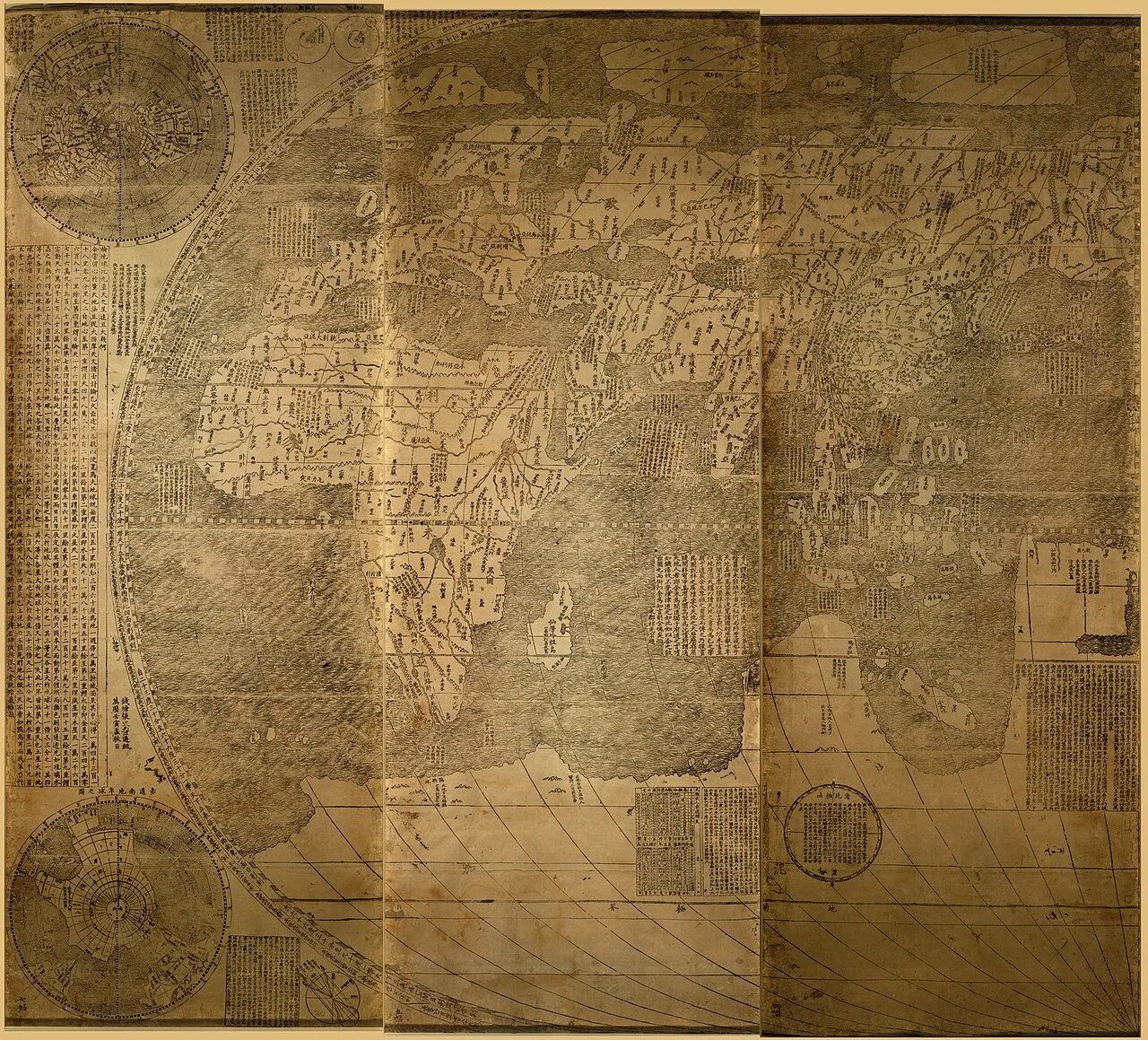
Left panels 1-3
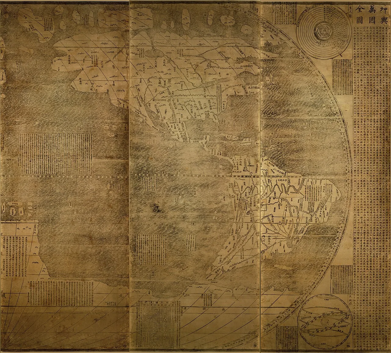
Right panels 4-6
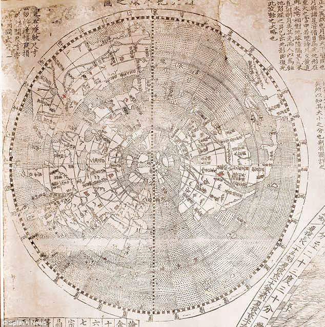
Small scale polar azimuthal projection of the northern hemisphere at the top of the first left panel of 1602 Ricci map
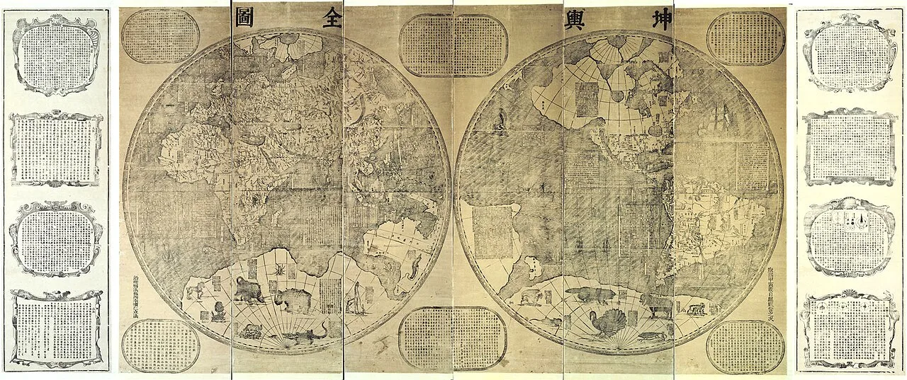
1674 Kunyu Quantu of Ferdinand Verbiest 2 hemispheres
![1620s Giulio Aleni world map Wanguo Quantu (萬國全圖),[23]](https://hmzpdsmr7uczkvx4.public.blob.vercel-storage.com/wikifeed/kunyu-wanguo-quantu/4-b487eaa84a.webp)
1620s Giulio Aleni world map Wanguo Quantu (萬國全圖),[23]
![1620s Wanguo Quantu map, by Giulio Aleni, whose Chinese name (艾儒略) appears in the signature in the last column on the left, above the Jesuit IHS symbol.[25]](https://hmzpdsmr7uczkvx4.public.blob.vercel-storage.com/wikifeed/kunyu-wanguo-quantu/5-a240e6aa06.webp)
1620s Wanguo Quantu map, by Giulio Aleni, whose Chinese name (艾儒略) appears in the signature in the last column on the left, above the Jesuit IHS symbol.[25]
Kunyu Wanguo Quantu
Kunyu Wanguo Quantu is a large world map produced in Ming-dynasty China in 1602.
Six Mulberry Panels Centered on the Middle Kingdom
Cartographers usually put their home continent at the center, but European cartography was altered here to match a Chinese worldview. Printed on six mulberry paper panels designed like a folding screen, the woodcut stretched 5 ft (1.52 m) high and 12 ft (3.66 m) wide. This massive canvas portrayed both the Americas and the Pacific Ocean while placing China directly at the center of the known world.
From Wikipedia · CC BY-SA 4.0
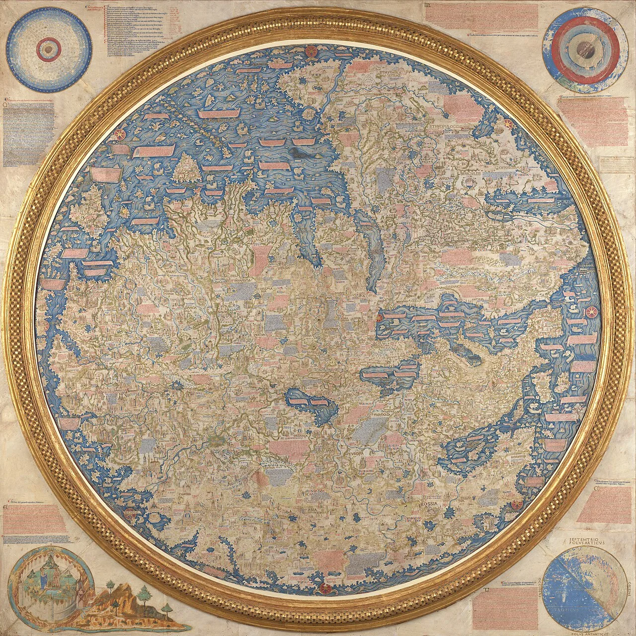
The Fra Mauro Map of the world. The map depicts Asia, Africa and Europe, with South at the top.
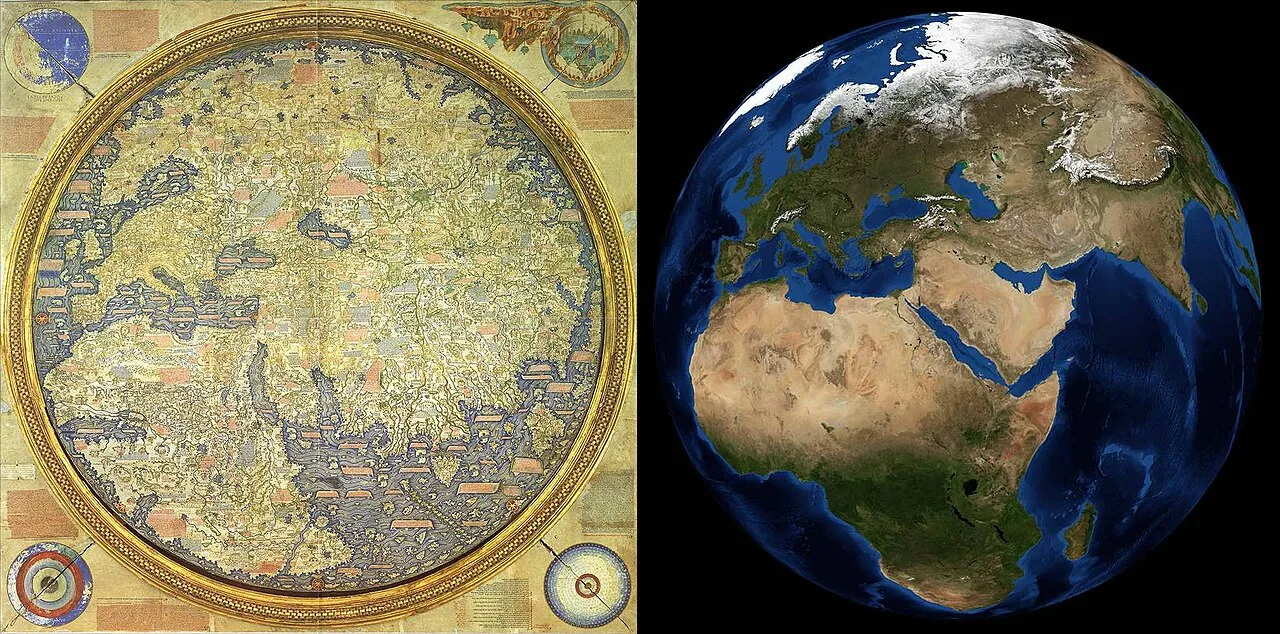
The Fra Mauro map upside-down to show North on top, compared to a modern satellite-based image of Earth by NASA
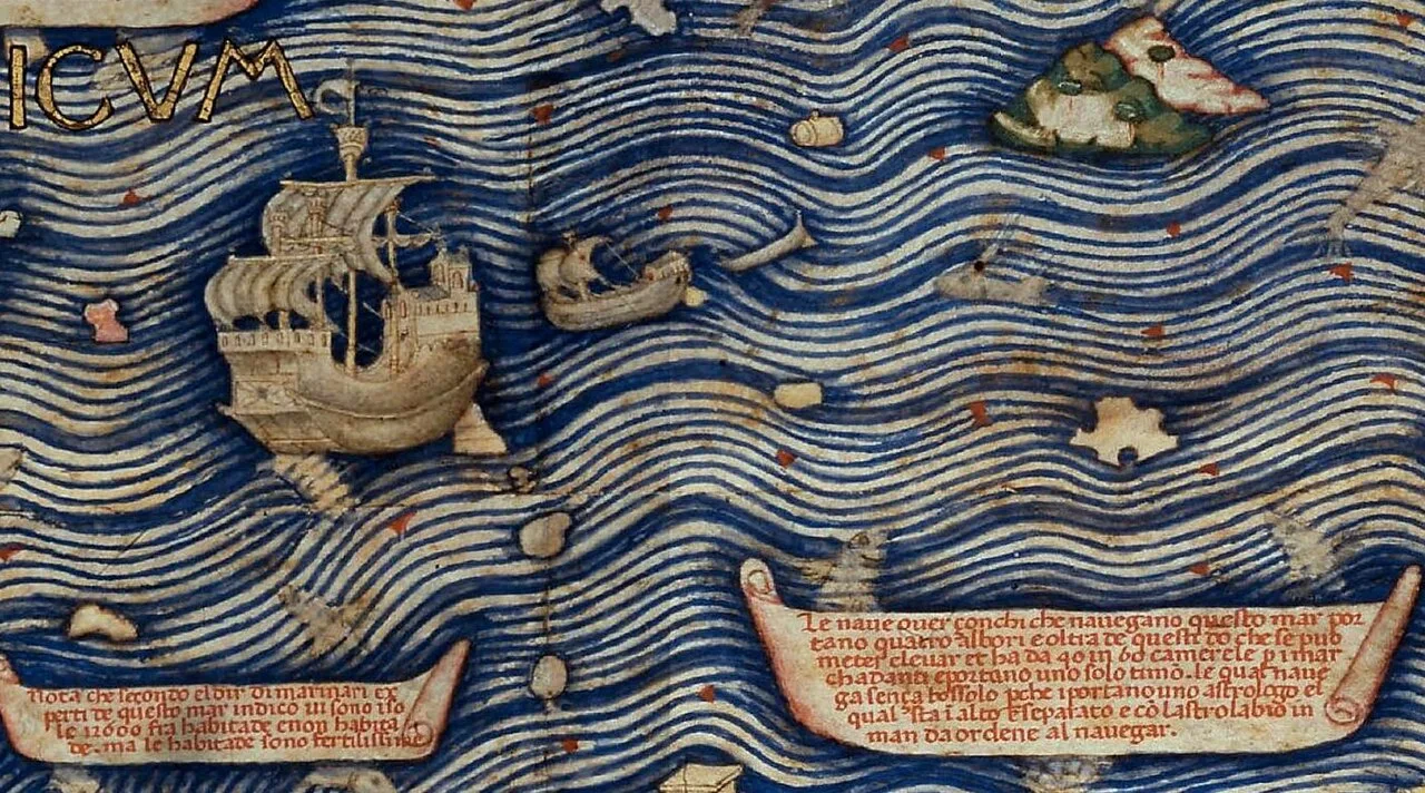
Detail of the Fra Mauro map, describing the construction of the junks that navigate in the Indian Ocean
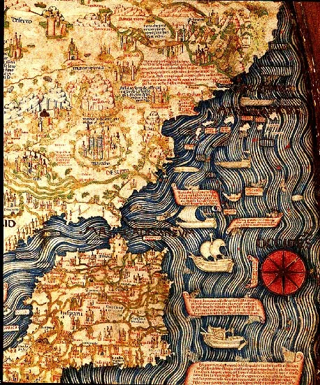
Spain, Portugal and Northern Africa
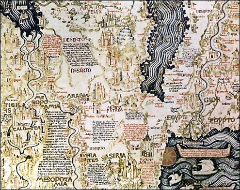
The Middle-East
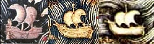
Depiction of a Chinese junk, an Atlantic ship and a Mediterranean ship in the Fra Mauro map.
Fra Mauro map
The Fra Mauro map is a circular world map drawn on parchment around 1450 by the Venetian cartographer Fra Mauro.
Flipping the Globe Southward
Modern cartography assumes north belongs at the top of a map, but medieval navigation followed entirely different practical rules. Fra Mauro constructed his grand world map with south at the top, directly matching the design of 15th-century south-pointing compasses. By turning the known world upside down relative to modern expectations, he deliberately aligned his work with practical seafaring tools rather than purely symbolic cartographic arrangements.
From Wikipedia · CC BY-SA 4.0
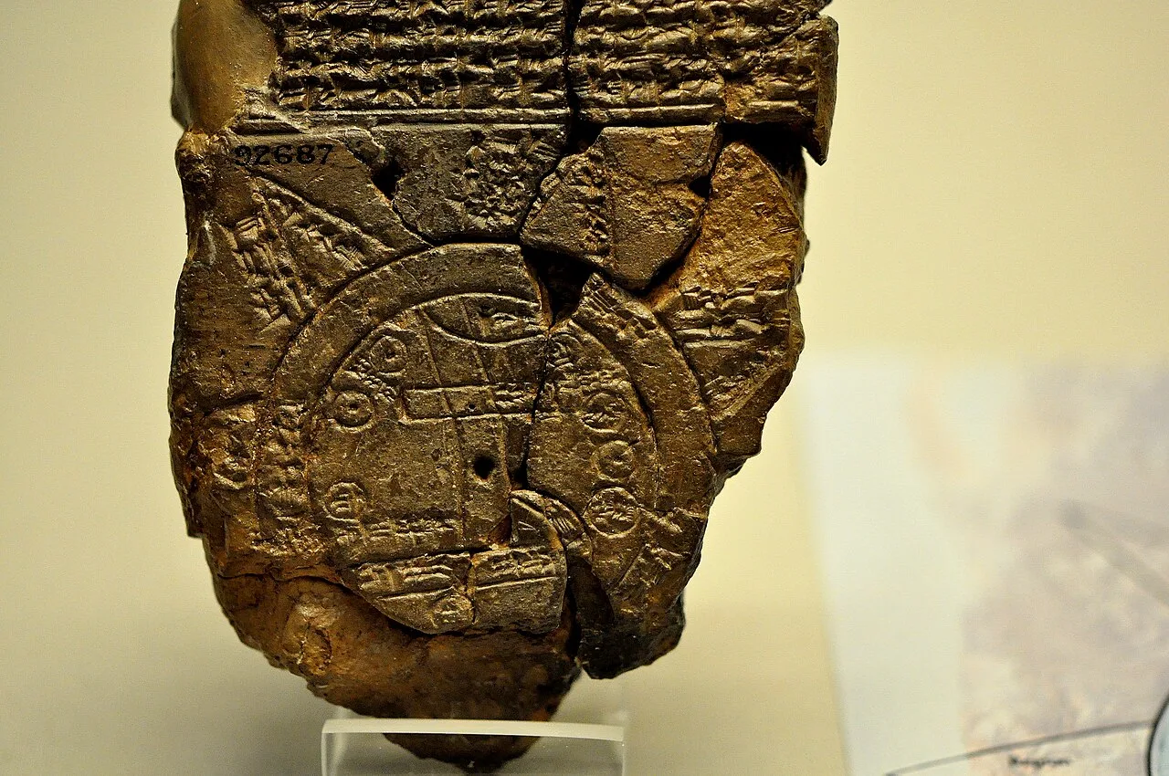
The Babylonian map of the world, from Sippar, Mesopotamia.
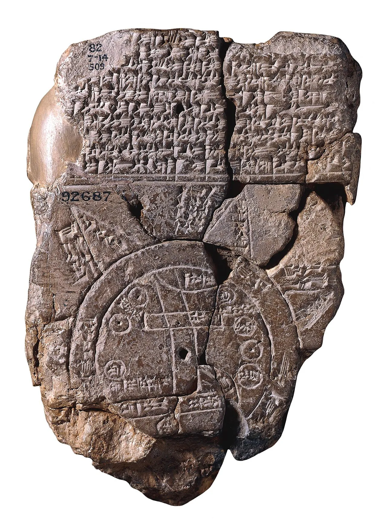
Babylonian Map of the World. The more vertical lines indicate the banks of Euphrates, where the Anunna worked, Gods of the Atra-Hasis Flood epic. The small circles show tribes as well as city states like Uruk, and the triangles mountains at the world's edge, including Ararat, on which Atra-Hasis - the "Babylonian Noah" - stranded with his Ark. The doubel ring is a symbol of the salt sea serpent Tiamat, the "bitter river" that flowed around the world as it was known.[10]
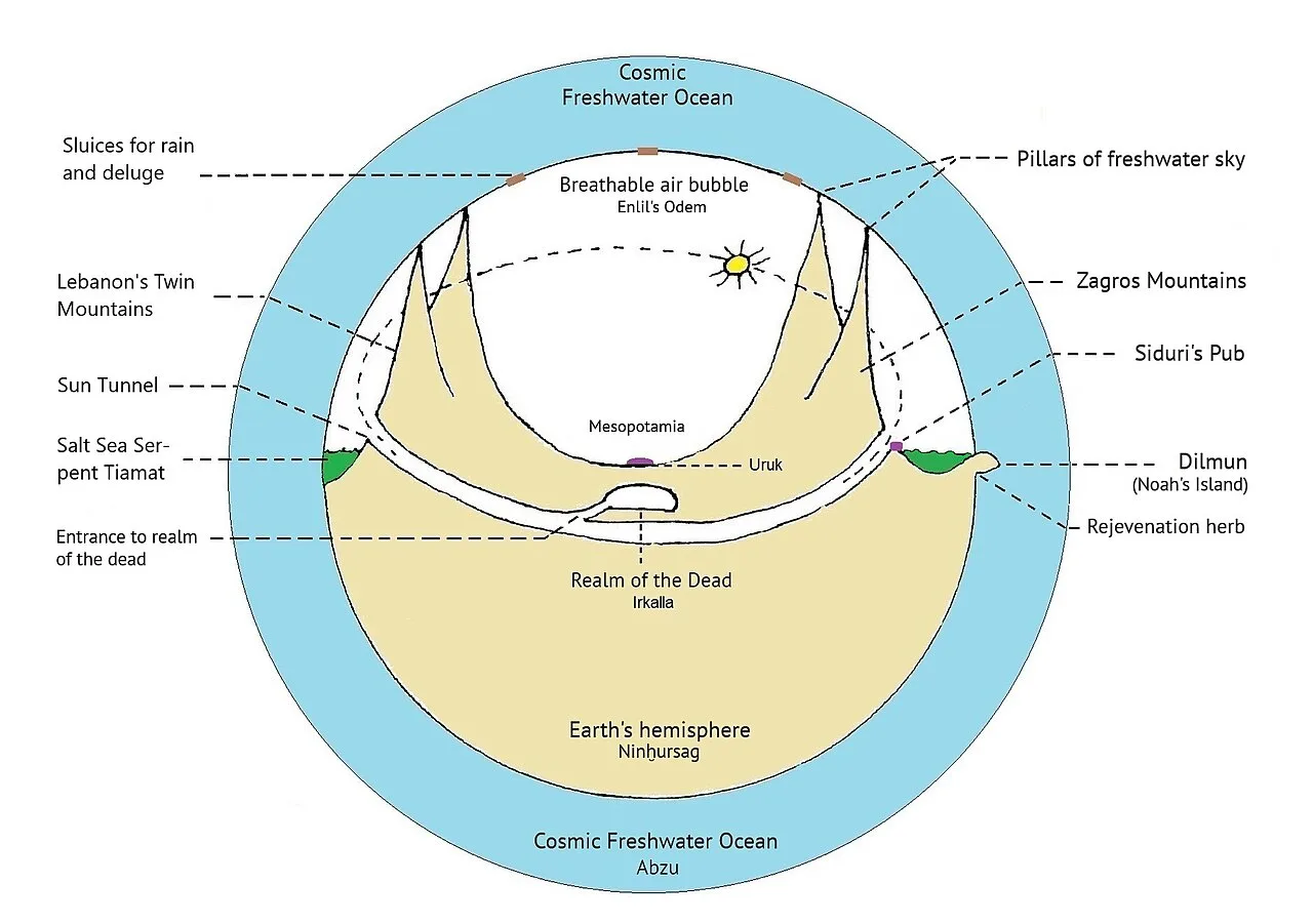
Illustration of Sumerian creation myths. They describe the Abzu as cosmic freshwater ocean, whose mating with serpent Tiamat – a symbol of the salty sea – gave rise to Mother Earth Ninhursag. The Abzu envelops our planet from above and below, whilst Tiamat, also called the "bitter river", flows around its edges, so the sketch shows the same as Babylon's map, now in sideview. A bubble of breathable air clings to earth, with the Abzu's boundary layer as "a roof" like on Athrahasis's lifeboat. Further details, such as the "Babylonian's Noah" island (Dilmun) and the tunnel (through which sun god Shamash travels at night), are taken from the text of the Babylonian world map as well as of the Gilgamesh epic.[16] An important technical detail are also the sluices built into sky. Through them, the gods, well skilled in construction of irrigation systems, supplied their garden land Eden with rain, but also unleashed the Flood.
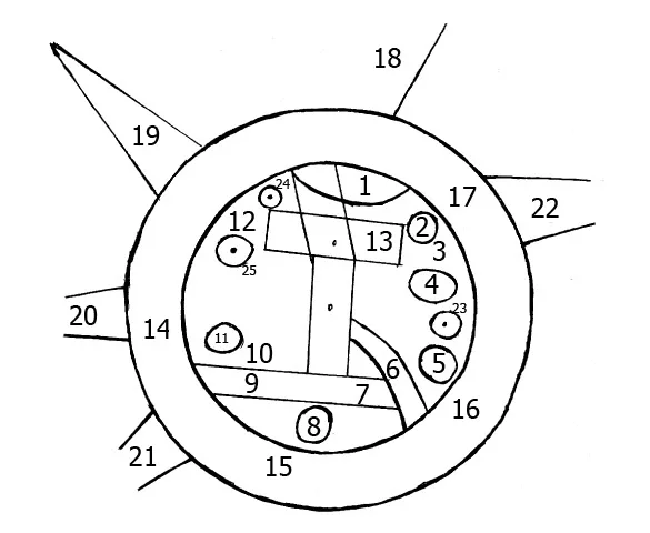
BabylonianWorldMap2
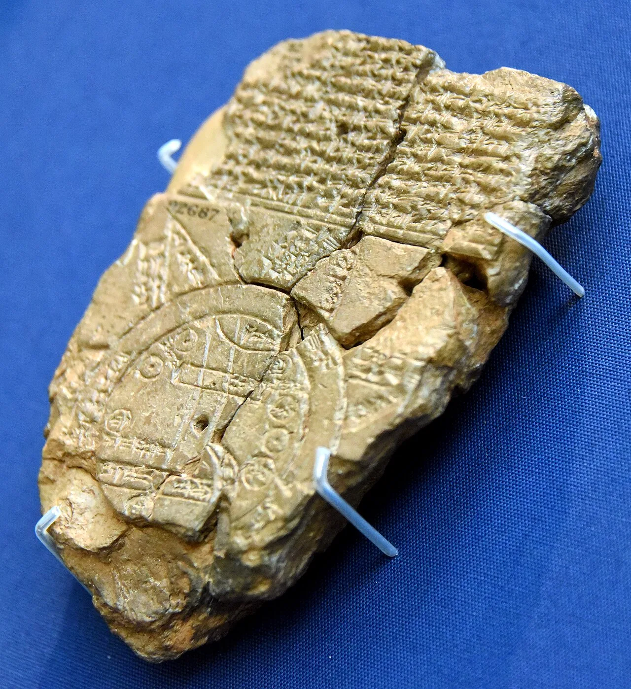
Map of the World from Sippar, Iraq. 6th century BCE. British Museum
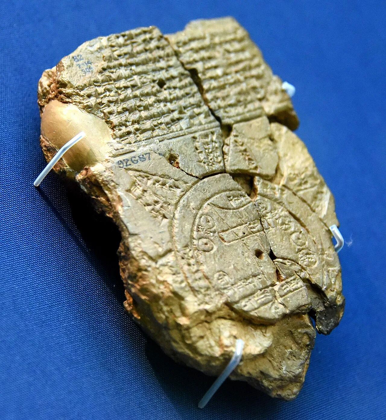
Map of the World from Sippar, Iraq, 6th century BCE. British Museum
Babylonian Map of the World
The Babylonian Map of the World is a Babylonian clay tablet featuring a schematic world map and inscriptions in the Akkadian language, representing the oldest known depiction of the then-known world.
Floating World and Divine Creation
The obverse inscription details how Marduk created the terrestrial world after parting the primeval salt ocean Tiamat. Rather than representing a solid terrestrial sphere anchored in space, the land is visualized as a giant raft floating on top of the sea. Upon this floating land mass, Marduk established legendary creatures alongside familiar animals, including the chameleon, ostrich, monkey, wolf, and cat. This cosmological framing grounds the map in divine creation rather than purely empirical geography.
From Wikipedia · CC BY-SA 4.0
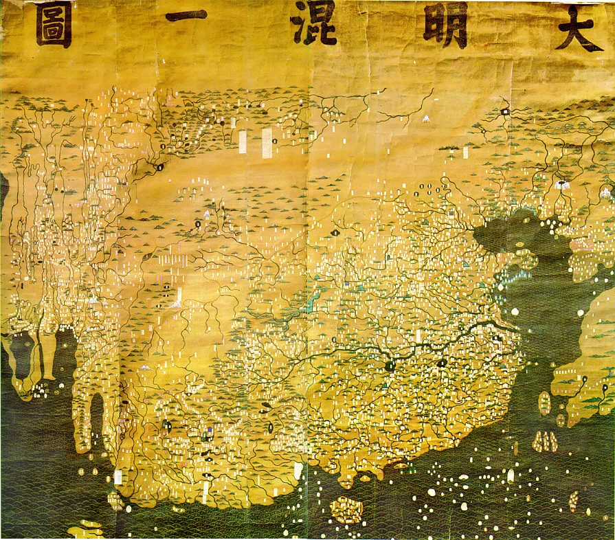
Da-ming-hun-yi-tu
Da Ming Hunyi Tu
The Da Ming Hunyi Tu, or Amalgamated Map of the Ming Empire, is an extensive Chinese map painted in colour on stiff silk.
Compressing Distant Continents to Mirror Planetary Spheres
Painted on stiff silk at a massive size of 386 x 456 cm, the map subtly incorporates global geometry into its design. Rather than using a uniform grid, its scale shifts horizontally to about 1:820,000 and vertically to around 1:1,060,000. This deliberate compression of areas farthest away from China effectively replicates the curvature of the Earth on a flat surface.
From Wikipedia · CC BY-SA 4.0